2024 Edition
CIA World Factbook 2024 (factbook.json @ b8538d78e87c)
Introduction
Background
The widely scattered Coral Sea Islands were first charted in 1803, but they were too small to host permanent human habitation. The 1870s and 1880s saw attempts at guano mining, but these were soon abandoned. The islands became an Australian territory in 1969, and the boundaries were extended in 1997. A small meteorological staff has operated on the Willis Islets since 1921, and several other islands host unmanned weather stations, beacons, and lighthouses. Much of the territory lies within national marine nature reserves.
Geography
Area
- land
- 3 sq km less than
- note
- note: includes numerous small islands and reefs scattered over a sea area of about 780,000 sq km (300,000 sq mi) with the Willis Islets the most important
- total
- 3 sq km less than
- water
- 0 sq km
Area - comparative
about four times the size of the National Mall in Washington, DC
Climate
tropical
Coastline
3,095 km
Elevation
- highest point
- unnamed location on Cato Island 9 m
- lowest point
- Pacific Ocean 0 m
Geographic coordinates
18 00 S, 152 00 E
Geography - note
important nesting area for birds and turtles
Land boundaries
- total
- 0 km
Land use
- agricultural land
- 0% (2018 est.)
- other
- 100% (2018 est.)
Location
Oceania, islands in the Coral Sea, northeast of Australia
Map references
Oceania
Maritime claims
- exclusive fishing zone
- 200 nm
- territorial sea
- 3 nm
Natural hazards
occasional tropical cyclones
Natural resources
fish
Terrain
sand and coral reefs and islands (cays)
People and Society
Population
- note
- note: a staff of four operates the meteorological station on Willis Island
- total
- no indigenous inhabitants (2021)
Government
Citizenship
see Australia
Country name
- conventional long form
- Coral Sea Islands Territory
- conventional short form
- Coral Sea Islands
- etymology
- self-descriptive name to reflect the islands' position in the Coral Sea off the northeastern coast of Australia
Dependency status
territory of Australia; administered from Canberra by the Department of Regional Australia, Local Government, Arts and Sport
Diplomatic representation from the US
- embassy
- none (territory of Australia)
Diplomatic representation in the US
none (territory of Australia)
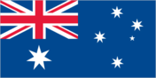
Flag description
the flag of Australia is used
Legal system
the common law legal system of Australia applies where applicable
Communications
Communications - note
automatic weather stations on many of the isles and reefs relay data to the mainland
Military and Security
Military - note
defense is the responsibility of Australia
Environment
Climate
tropical
Environment - current issues
no permanent freshwater resources; damaging activities include coral mining, destructive fishing practices (overfishing, blast fishing)
Land use
- agricultural land
- 0% (2018 est.)
- other
- 100% (2018 est.)