2006 Edition
CIA World Factbook 2006 (Project Gutenberg)
Introduction
Area
- land
- less than 3 sq km
- note
- includes numerous small islands and reefs scattered over a sea area of about 780,000 sq km, with the Willis Islets the most important
- total
- less than 3 sq km
- water
- 0 sq km
Area - comparative
NA
Background
Scattered over more than three-quarters of a million square kilometers of ocean, the Coral Sea Islands were declared a territory of Australia in 1969. They are uninhabited except for a small meteorological staff on the Willis Islets. Automated weather stations, beacons, and a lighthouse occupy many other islands and reefs. Geography Coral Sea Islands
Climate
tropical
Coastline
3,095 km
Communications - note
there are automatic weather stations on many of the isles and reefs relaying data to the mainland Transportation Coral Sea Islands
Country name
- conventional long form
- Coral Sea Islands Territory
- conventional short form
- Coral Sea Islands
Dependency status
territory of Australia; administered from Canberra by the Department of the Environment, Sport, and Territories
Diplomatic representation from the US
none (territory of Australia)
Diplomatic representation in the US
none (territory of Australia)
Disputes - international
none This page was last updated on 19 December, 2006
Economy - overview
no economic activity Communications Coral Sea Islands
Elevation extremes
- highest point
- unnamed location on Cato Island 6 m
- lowest point
- Pacific Ocean 0 m
Environment - current issues
no permanent fresh water resources
Executive branch
administered from Canberra by the Department of the Environment, Sport, and Territories
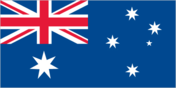
Flag description
the flag of Australia is used Economy Coral Sea Islands
Geographic coordinates
18 00 S, 152 00 E
Geography - note
important nesting area for birds and turtles People Coral Sea Islands
Irrigated land
0 sq km
Land boundaries
0 km
Land use
- arable land
- 0%
- other
- 100% (mostly grass or scrub cover) (2005)
- permanent crops
- 0%
Legal system
the laws of Australia, where applicable, apply
Location
Oceania, islands in the Coral Sea, northeast of Australia
Map references
Oceania
Maritime claims
- exclusive fishing zone
- 200 nm
- territorial sea
- 3 nm
Military - note
defense is the responsibility of Australia; visited regularly by the Royal Australian Navy; Australia has control over the activities of visitors Transnational Issues Coral Sea Islands
Natural hazards
occasional tropical cyclones
Natural resources
NEGL
Population
- no indigenous inhabitants
- note
- there is a staff of three to four at the meteorological station (2005 est.) Government Coral Sea Islands
Ports and terminals
none; offshore anchorage only Military Coral Sea Islands
Terrain
sand and coral reefs and islands (or cays)