1996 Edition
CIA World Factbook 1996 (Project Gutenberg)
Introduction
Description
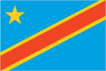
light green with a yellow disk in the center bearing a black arm holding a red flaming torch; the flames of the torch are blowing away from the hoist side; uses the popular pan-African colors of Ethiopia
Location
0 00 N, 25 00 E -- Central Africa, northeast of Angola Flag ----
Geography
Area
- comparative area
- slightly more than one-fourth the size of US
- land area
- 2,267,600 sq km
- total area
- 2,345,410 sq km
Climate
tropical; hot and humid in equatorial river basin; cooler and drier in southern highlands; cooler and wetter in eastern highlands; north of Equator - wet season April to October, dry season December to February; south of Equator - wet season November to March, dry season April to October
Coastline
37 km
Environment
- current issues
- poaching threatens wildlife populations; water pollution; deforestation; 1.2 million Rwandan refugees are responsible for significant deforestation, soil erosion, and wildlife poaching in eastern Zaire
- international agreements
- party to - Biodiversity, Climate Change, Endangered Species, Hazardous Wastes, Law of the Sea, Marine Dumping, Nuclear Test Ban, Ozone Layer Protection, Tropical Timber 83; signed, but not ratified - Desertification, Environmental Modification
- natural hazards
- periodic droughts in south; volcanic activity
Geographic coordinates
0 00 N, 25 00 E
Geographic note
straddles Equator; very narrow strip of land that controls the lower Congo river and is only outlet to South Atlantic Ocean; dense tropical rain forest in central river basin and eastern highlands
International disputes
Tanzania-Zaire-Zambia tripoint in Lake Tanganyika may no longer be indefinite since it has been informally reported that the indefinite section of the Zaire-Zambia boundary has been settled; long section with Congo along the Congo river is indefinite (no division of the river or its islands has been made)
Irrigated land
100 sq km (1989 est.)
Land boundaries
- border countries
- Angola 2,511 km, Burundi 233 km, Central African Republic 1,577 km, Congo 2,410 km, Rwanda 217 km, Sudan 628 km, Uganda 765 km, Zambia 1,930 km
- total
- 10,271 km
Land use
- arable land
- 3%
- forest and woodland
- 78%
- meadows and pastures
- 4%
- other
- 15%
- permanent crops
- 0%
Location
Central Africa, northeast of Angola
Map references
Africa
Maritime claims
- exclusive economic zone
- boundaries with neighbors
- territorial sea
- 12 nm
Natural resources
cobalt, copper, cadmium, petroleum, industrial and gem diamonds, gold, silver, zinc, manganese, tin, germanium, uranium, radium, bauxite, iron ore, coal, hydropower potential
Terrain
- vast central basin is a low-lying plateau; mountains in east
- highest point
- Margherita Peak (Mount Stanley) 5,110 m
- lowest point
- Atlantic Ocean 0 m
People and Society
Age structure
0-14 years: 48% (male 11,161,347; female 11,124,583) 15-64 years: 49% (male 11,197,097; female 11,783,524) 65 years and over: 3% (male 539,775; female 692,213) (July 1996 est.)
Birth rate
48.1 births/1,000 population (1996 est.)
Death rate
16.9 deaths/1,000 population (1996 est.)
Ethnic divisions
over 200 African ethnic groups, the majority are Bantu; four largest tribes - Mongo, Luba, Kongo (all Bantu), and the Mangbetu-Azande (Hamitic) make up about 45% of the population
Infant mortality rate
108 deaths/1,000 live births (1996 est.)
Languages
French (official), Lingala (a lingua franca trade language), Kingwana (a dialect of Kiswahili or Swahili), Kikongo, Tshiluba
Life expectancy at birth
- female
- 48.47 years (1996 est.)
- male
- 44.97 years
- total population
- 46.7 years
Literacy
- age 15 and over can read and write in French, Lingala, Kingwana, or Tshiluba (1995 est.)
- female
- 67.7%
- male
- 86.6%
- total population
- 77.3%
Nationality
- adjective
- Zairian
- noun
- Zairian(s)
Net migration rate
- -14.56 migrant(s)/1,000 population (1996 est.)
- note
- in 1994, more than one million refugees fled into Zaire to escape the fighting between the Hutus and the Tutsis in Rwanda and Burundi; a small number of these returned to their homes in 1995 despite fear of the ongoing violence; additionally, Zaire is host to about 100,000 Angolan, and about 100,000 Sudanese refugees
Population
46,498,539 (July 1996 est.)
Population growth rate
1.67% (1996 est.)
Religions
Roman Catholic 50%, Protestant 20%, Kimbanguist 10%, Muslim 10%, other syncretic sects and traditional beliefs 10%
Sex ratio
- all ages
- 0.97 male(s)/female (1996 est.)
- at birth
- 1.03 male(s)/female
- under 15 years
- 1 male(s)/female 15-64 years: 0.95 male(s)/female 65 years and over: 0.78 male(s)/female
Total fertility rate
6.64 children born/woman (1996 est.)
Government
Administrative divisions
10 regions (regions, singular - region) and 1 town* (ville); Bandundu, Bas-Zaire, Equateur, Haut-Zaire, Kasai-Occidental, Kasai-Oriental, Kinshasa*, Maniema, Nord-Kivu, Shaba, Sud-Kivu
Capital
Kinshasa
Constitution
24 June 1967, amended August 1974, revised 15 February 1978; amended April 1990; new transitional constitution promulgated in April 1994
Data code
CG
Diplomatic representation in US
- chancery
- 1800 New Hampshire Avenue NW, Washington, DC 20009
- chief of mission
- Ambassador TATANENE Manata
- telephone
- [1] (202) 234-7690, 7691
Executive branch
- cabinet
- National Executive Council, appointed by mutual agreement of the president and the prime minister
- chief of state
- President Marshal MOBUTU Sese Seko Kuku Ngbendu wa Za Banga (since 24 November 1965) elected for a seven-year term by popular vote; election last held 29 July 1984 (next to be held by 9 July 1997); results - President MOBUTU was reelected without opposition
- head of government
- Prime Minister Leon KENGO wa Dondo (since 14 June 1994) elected by the High Council of the Republic
FAX
[243] (88) 43805, ext. 2308 or 43467
Flag
light green with a yellow disk in the center bearing a black arm holding a red flaming torch; the flames of the torch are blowing away from the hoist side; uses the popular pan-African colors of Ethiopia
Independence
30 June 1960 (from Belgium)
International organization participation
ACCT, ACP, AfDB, CCC, CEEAC, CEPGL, ECA, FAO, G-19, G-24, G-77, IAEA, IBRD, ICAO, ICC, ICRM, IDA, IFAD, IFC, IFRCS, ILO, IMF, IMO, Intelsat, Interpol, IOC, ITU, NAM, OAU, PCA, UN, UNCTAD, UNESCO, UNHCR, UNIDO, UPU, WCL, WFTU, WHO, WIPO, WMO, WToO
Judicial branch
Supreme Court (Cour Supreme)
Legal system
based on Belgian civil law system and tribal law; has not accepted compulsory ICJ jurisdiction
Legislative branch
- unicameral
- parliament
- a single body consisting of the High Council of the Republic and the Parliament of the Transition with membership equally divided between presidential supporters and opponents
Name of country
- conventional long form
- Republic of Zaire
- conventional short form
- Zaire
- former
- Belgian Congo Congo/Leopoldville Congo/Kinshasa
- local long form
- Republique du Zaire
- local short form
- Zaire
National holiday
Anniversary of the Regime (Second Republic), 24 November (1965)
Political parties and leaders
sole legal party until January 1991 - Popular Movement of the Revolution (MPR); other parties include Union for Democracy and Social Progress (UDPS), Etienne TSHISEKEDI wa Mulumba; Democratic Social Christian Party (PDSC); Union of Federalists and Independent Republicans (UFERI); Unified Lumumbast Party (PALU), Antoine GIZENGA; Union of Independent Democrats (UDI), Leon KENGO wa Dondo
Suffrage
18 years of age; universal and compulsory
Type of government
republic with a strong presidential system
US diplomatic representation
- chief of mission
- Ambassador Daniel H. SIMPSON
- embassy
- 310 Avenue des Aviateurs, Kinshasa
- mailing address
- Unit 31550, APO AE 09828
- telephone
- [243] (12) 21533 through 21535
Economy
Agriculture
coffee, sugar, palm oil, rubber, tea, quinine, cassava (tapioca), palm oil, bananas, root crops, corn, fruits; wood products
Budget
- expenditures
- $479 million, including capital expenditures of $NA (1996 est.)
- revenues
- $479 million
Currency
1 zaire (Z) = 100 makuta
Economic aid
- recipient
- ODA, $NA
Economic overview
Zaire's economy has continued to disintegrate, although Prime Minister KENGO has had some success in slowing the rate of economic decline. While meaningful economic figures are difficult to come by, Zaire's hyperinflation, chronic large government deficits, and plunging mineral production have made the country one of the world's poorest. Most formal transactions are conducted in hard currency as indigenous bank notes have lost almost all value, and a barter economy now flourishes in all but the largest cities. Most individuals and families hang on grimly through subsistence farming and petty trade. The government has not been able to meet its financial obligations to the IMF nor put in place the financial measures advocated by it. Although short-term prospects for improvement remain doubtful, improved political stability would boost Zaire's long-term potential to effectively exploit its vast mineral and agricultural resources.
Electricity
- capacity
- 2,830,000 kW
- consumption per capita
- 133 kWh (1993)
- production
- 6.2 billion kWh
Exchange rates
- new zaires (Z) per US$1 - 10,618 (October 1995), 1,194 (1994), 3 (1993); zaire (Z) per US$1 - 645,549 (1992), 15,587 (1991)
- note
- on 22 October 1993 the new zaire, equal to 3,000,000 old zaires, was introduced
Exports
- $419 million (f.o.b., 1994)
- commodities
- copper, coffee, diamonds, cobalt, crude oil
- partners
- US, Belgium, France, Germany, Italy, UK, Japan, South Africa
External debt
$11.3 billion (December 1993 est.)
Fiscal year
calendar year
GDP
purchasing power parity - $16.5 billion (1995 est.)
GDP composition by sector
- agriculture
- NA%
- industry
- NA%
- services
- NA%
GDP per capita
$400 (1995 est.)
GDP real growth rate
-7.4% (1995 est.)
Illicit drugs
illicit producer of cannabis, mostly for domestic consumption
Imports
- $382 million (c.i.f., 1994)
- commodities
- consumer goods, foodstuffs, mining and other machinery, transport equipment, fuels
- partners
- South Africa, US, Belgium, France, Germany, Italy, Japan, UK
Industrial production growth rate
-20% (1993)
Industries
mining, mineral processing, consumer products (including textiles, footwear, cigarettes, processed foods and beverages), cement, diamonds
Inflation rate (consumer prices)
12% monthly average (1995 est.)
Labor force
- 14.51 million (1993 est.)
- by occupation
- agriculture 65%, industry 16%, services 19% (1991 est.)
Unemployment rate
NA%
Communications
Branches
Army, Navy, Air Force, National Gendarmerie, paramilitary Civil Guard, Special Presidential Division
Defense expenditures
exchange rate conversion - $46 million, 1.5% of GDP (1990)
Manpower availability
- males age 15-49
- 10,025,536
- males fit for military service
- 5,108,385 (1996 est.)
Radio broadcast stations
AM 10, FM 4, shortwave 0
Radios
3.87 million (1992 est.)
Telephone system
- domestic
- barely adequate wire and microwave radio relay service in and between urban areas; domestic satellite system with 14 earth stations
- international
- satellite earth station - 1 Intelsat (Atlantic Ocean)
Telephones
34,000 (1991 est.)
Television broadcast stations
18
Televisions
55,000 (1992 est.) Defense
Transportation
Airports
- total
- 217
- with paved runways 1 524 to 2 437 m
- 15
- with paved runways 2 438 to 3 047 m
- 3
- with paved runways 914 to 1 523 m
- 2
- with paved runways over 3 047 m
- 4
- with paved runways under 914 m
- 82
- with unpaved runways 1 524 to 2 437 m
- 17
- with unpaved runways 914 to 1 523 m
- 94 (1995 est.)
Highways
- paved
- 290 km
- total
- 145,000 km
- unpaved
- 144,710 km (1991 est.)
Merchant marine
none
Pipelines
petroleum products 390 km
Ports
Banana, Boma, Bukavu, Bumba, Goma, Kalemie, Kindu, Kinshasa, Kisangani, Matadi, Mbandaka
Railways
- narrow gauge
- 3,987 km 1.067-m gauge (858 km electrified); 125 km 1.000-m gauge; 1,026 km 0.600-m gauge
- total
- 5,138 km (1995); note - severely reduced trackage in use because of civil strife
Waterways
15,000 km including the Congo, its tributaries, and unconnected lakes