2008 Edition
CIA World Factbook 2008 (Project Gutenberg)
Introduction
Background
There are 27 coral islands in the group. Captain William KEELING discovered the islands in 1609, but they remained uninhabited until the 19th century. From the 1820s to 1978, members of the CLUNIE-ROSS family controlled the islands and the copra produced from local coconuts. Annexed by the UK in 1857, the Cocos Islands were transferred to the Australian Government in 1955. The population on the two inhabited islands generally is split between the ethnic Europeans on West Island and the ethnic Malays on Home Island.
Geography
Area
total: 14 sq km land: 14 sq km water: 0 sq km note: includes the two main islands of West Island and Home Island
Area - comparative
about 24 times the size of The Mall in Washington, DC
Climate
tropical with high humidity, moderated by the southeast trade winds for about nine months of the year
Coastline
26 km
Elevation extremes
lowest point: Indian Ocean 0 m highest point: unnamed location 5 m
Environment - current issues
fresh water resources are limited to rainwater accumulations in natural underground reservoirs
Geographic coordinates
12 30 S, 96 50 E
Geography - note
islands are thickly covered with coconut palms and other vegetation; site of a World War I naval battle in November 1914 between the Australian light cruiser HMAS Sydney and the German raider SMS Emden; after being heavily damaged in the engagement, the Emden was beached by her captain on North Keeling Island
Irrigated land
NA
Land boundaries
0 km
Land use
arable land: 0% permanent crops: 0% other: 100% (2005)
Location
Southeastern Asia, group of islands in the Indian Ocean, southwest of Indonesia, about halfway from Australia to Sri Lanka
Map references
Southeast Asia
Maritime claims
territorial sea: 12 nm exclusive fishing zone: 200 nm
Natural hazards
cyclone season is October to April
Natural resources
fish
Terrain
flat, low-lying coral atolls
People and Society
Age structure
0-14 years: NA 15-64 years: NA 65 years and over: NA
Birth rate
NA (2008 est.)
Death rate
NA (2008 est.)
Ethnic groups
Europeans, Cocos Malays
HIV/AIDS - adult prevalence rate
NA
HIV/AIDS - deaths
NA
HIV/AIDS - people living with HIV/AIDS
NA
Infant mortality rate
total: NA male: NA female: NA (2008 est.)
Languages
Malay (Cocos dialect), English
Life expectancy at birth
total population: NA male: NA female: NA (2008 est.)
Literacy
NA
Nationality
noun: Cocos Islander(s) adjective: Cocos Islander
Net migration rate
NA (2008 est.)
Population
596 (July 2007 est.)
Population growth rate
0% (2008 est.)
Religions
Sunni Muslim 80%, other 20% (2002 est.)
Total fertility rate
NA (2008 est.)
Government
Administrative divisions
none (territory of Australia)
Capital
name: West Island geographic coordinates: 12 10 S, 96 50 E time difference: UTC+6.5 (11.5 hours ahead of Washington, DC during Standard Time)
Constitution
Cocos (Keeling) Islands Act of 1955 (23 November 1955) as amended by the Territories Law Reform Act of 1992
Country name
conventional long form: Territory of Cocos (Keeling) Islands conventional short form: Cocos (Keeling) Islands
Dependency status
non-self governing territory of Australia; administered from Canberra by the Australian Attorney-General's Department
Diplomatic representation from the US
none (territory of Australia)
Diplomatic representation in the US
none (territory of Australia)
Executive branch
chief of state: Queen ELIZABETH II (since 6 February 1952); represented by the Australian governor general head of government: Administrator (nonresident) Neil LUCAS (since 30 January 2006) cabinet: NA elections: the monarch is hereditary; administrator appointed by the governor general of Australia and represents the monarch and Australia
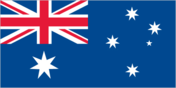
Flag description
the flag of Australia is used
Government type
NA
Independence
none (territory of Australia)
International organization participation
none
Judicial branch
Supreme Court; Magistrate's Court
Legal system
based upon the laws of Australia and local laws
Legislative branch
unicameral Cocos (Keeling) Islands Shire Council (7 seats) elections: held every two years with half the members standing for election; last held in May 2007 (next to be held in May 2009)
National holiday
Australia Day, 26 January (1788)
Political parties and leaders
none
Political pressure groups and leaders
The Cocos Islands Youth Support Centre
Suffrage
NA
Economy
Agriculture - products
vegetables, bananas, pawpaws, coconuts
Budget
revenues: $NA expenditures: $NA
Currency (code)
Australian dollar (AUD)
Currency code
AUD
Economic aid - recipient
$NA
Economy - overview
Grown throughout the islands, coconuts are the sole cash crop. Small local gardens and fishing contribute to the food supply, but additional food and most other necessities must be imported from Australia. There is a small tourist industry.
Electricity - production by source
fossil fuel: NA hydro: NA nuclear: NA other: NA
Exchange rates
Australian dollars (AUD) per US dollar - 1.2137 (2007), 1.3285 (2006), 1.3095 (2005), 1.3598 (2004), 1.5419 (2003)
Exports
$NA
Exports - commodities
copra
Exports - partners
Australia (2006)
Fiscal year
1 July - 30 June
GDP (purchasing power parity)
$NA
Imports
$NA
Imports - commodities
foodstuffs
Imports - partners
Australia (2006)
Industries
copra products and tourism
Labor force
NA
Labor force - by occupation
note: the Cocos Islands Cooperative Society Ltd. employs construction workers, stevedores, and lighterage workers; tourism employs others
Unemployment rate
60% (2000 est.)
Communications
Internet country code
.cc
Internet Service Providers (ISPs)
2 (2000)
Internet users
NA
Radio broadcast stations
AM 1, FM 2, shortwave 0 (2004)
Radios
300 (1992)
Telephone system
general assessment: connected within Australia's telecommunication system; a local mobile-cellular network is in operation domestic: NA international: country code - 61; telephone, telex, and facsimile communications with Australia and elsewhere via satellite; satellite earth station - 1 (Intelsat) (2001)
Telephones - main lines in use
287 (1992)
Television broadcast stations
4 (2007)
Televisions
NA
Transportation
Airports
1 (2007)
Airports - with paved runways
total: 1 1,524 to 2,437 m: 1 (2007)
Ports and terminals
Port Refuge
Roadways
total: 22 km paved: 10 km unpaved: 12 km (2006)
Military and Security
Military - note
defense is the responsibility of Australia; the territory has a five-person police force
Transnational Issues
Disputes - international
none This page was last updated on 18 December, 2008