1994 Edition
CIA World Factbook 1994 (Project Gutenberg)
Introduction
Administrative divisions
none (territory of Australia)
Affiliation
(territory of Australia)
Agriculture
NA
Airports
total: 1 usable: 1 with permanent-surface runways: 1 with runways over 3,659 m: with runways 2,440-3,659 m: with runways 1,220-2,439 m: 1
Area
total area: 135 sq km land area: 135 sq km comparative area: about 0.8 times the size of Washington, DC
Birth rate
NA
Budget
revenues: $NA expenditures: $NA, including capital expenditures of $NA
Capital
The Settlement
Climate
tropical; heat and humidity moderated by trade winds
Coastline
138.9 km
Constitution
Christmas Island Act of 1958
Currency
1 Australian dollar ($A) = 100 cents
Death rate
NA
Digraph
KT
Diplomatic representation in US
none (territory of Australia)
Economic aid
none
Electricity
capacity: 11,000 kW production: 30 million kWh consumption per capita: 17,800 kWh (1990)
Environment
current issues: NA natural hazards: almost completely surrounded by a reef international agreements: NA
Ethnic divisions
Chinese 61%, Malay 25%, European 11%, other 3%, no indigenous population
Exchange rates
Australian dollars ($A) per US$1 - 1.4364 (January 1994), 1.4704, (1993), 1.3600 (1992), 1.2836 (1991), 1.2799 (1990), 1.2618 (1989)
Executive branch
chief of state: Queen ELIZABETH II (since 6 February 1952) head of government: Administrator M. J. GRIMES (since NA) cabinet: Advisory Council
Exports
$NA commodities: phosphate partners: Australia, NZ
External debt
$NA
Fiscal year
1 July - 30 June
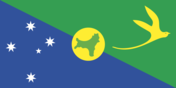
Flag
the flag of Australia is used
Highways
total: NA paved: NA unpaved: NA
Imports
$NA commodities: consumer goods partners: principally Australia
Independence
none (territory of Australia)
Industrial production
growth rate NA%
Industries
phosphate extraction (near depletion)
Infant mortality rate
NA
Inflation rate (consumer prices)
NA%
International disputes
none
Irrigated land
NA sq km
Judicial branch
none
Labor force
NA by occupation: all workers are employees of the Phosphate Mining Company of Christmas Island, Ltd.
Land boundaries
0 km
Land use
arable land: 0% permanent crops: 0% meadows and pastures: 0% forest and woodland: 0% other: 100%
Languages
English
Legal system
under the authority of the governor general of Australia
Legislative branch
none
Life expectancy at birth
total population: NA male: NA female: NA
Literacy
total population: NA% male: NA% female: NA%
Location
Southeastern Asia, in the Indian Ocean, between Australia and Indonesia
Map references
Southeast Asia
Maritime claims
contiguous zone: 12 nm exclusive fishing zone: 200 nm territorial sea: 3 nm
Member of
none
Names
conventional long form: Territory of Christmas Island conventional short form: Christmas Island
National holiday
NA
National product
GDP $NA
National product per capita
$NA
National product real growth rate
NA%
Nationality
noun: Christmas Islander(s) adjective: Christmas Island
Natural resources
phosphate
Net migration rate
NA
Note
- located along major sea lanes of Indian Ocean
- defense is the responsibility of Australia
Overview
Phosphate mining had been the only significant economic activity, but in December 1987 the Australian Government closed the mine as no longer economically viable. Plans have been under way to reopen the mine and also to build a casino and hotel to develop tourism.
Political parties and leaders
none
Population
973 (July 1994 est.)
Population growth rate
-9% (1994 est.)
Ports
Flying Fish Cove
Religions
Buddhist 36.1%, Muslim 25.4%, Christian 17.7% (Roman Catholic 8.2%, Church of England 3.2%, Presbyterian 0.9%, Uniting Church 0.4%, Methodist 0.2%, Baptist 0.1%, and other 4.7%), none 12.7%, unknown 4.6%, other 3.5% (1981)
Telecommunications
broadcast stations - 1 AM, 1 TV
Terrain
steep cliffs along coast rise abruptly to central plateau
Total fertility rate
NA
Type
territory of Australia
Unemployment rate
NA%
US diplomatic representation
none (territory of Australia)