1996 Edition
CIA World Factbook 1996 (Project Gutenberg)
Introduction
Description
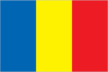
three equal vertical bands of blue (hoist side), yellow, and red; similar to the flag of Romania; also similar to the flag of Andorra, which has a national coat of arms featuring a quartered shield centered in the yellow band; design was based on the flag of France
Location
15 00 N, 19 00 E -- Central Africa, south of Libya Flag ----
Geography
Area
- comparative area
- slightly more than three times the size of California
- land area
- 1,259,200 sq km
- total area
- 1.284 million sq km
Climate
tropical in south, desert in north
Coastline
0 km (landlocked)
Environment
- current issues
- inadequate supplies of potable water; improper waste disposal in rural areas contributes to soil and water pollution; desertification
- international agreements
- party to - Biodiversity, Climate Change, Endangered Species, Nuclear Test Ban, Ozone Layer Protection, Wetlands; signed, but not ratified - Desertification, Law of the Sea, Marine Dumping
- natural hazards
- hot, dry, dusty harmattan winds occur in north; periodic droughts; locust plagues
Geographic coordinates
15 00 N, 19 00 E
Geographic note
landlocked; Lake Chad is the most significant water body in the Sahel
International disputes
the International Court of Justice (ICJ) ruled in February 1994 that the 100,000 sq km Aozou Strip between Chad and Libya belongs to Chad and that Libya must withdraw from it by 31 May 1994; Libya has withdrawn some of its forces in response to the ICJ ruling, but still maintains part of the airfield and a small military presence at the airfield's water supply located in Chad; demarcation of international boundaries in vicinity of Lake Chad, the lack of which has led to border incidents in the past, is completed and awaiting ratification by Cameroon, Chad, Niger, and Nigeria
Irrigated land
100 sq km (1989 est.)
Land boundaries
- border countries
- Cameroon 1,094 km, Central African Republic 1,197 km, Libya 1,055 km, Niger 1,175 km, Nigeria 87 km, Sudan 1,360 km
- total
- 5,968 km
Land use
- arable land
- 2%
- forest and woodland
- 11%
- meadows and pastures
- 36%
- other
- 51%
- permanent crops
- 0%
Location
Central Africa, south of Libya
Map references
Africa
Maritime claims
none (landlocked)
Natural resources
petroleum (unexploited but exploration under way), uranium, natron, kaolin, fish (Lake Chad)
Terrain
- broad, arid plains in center, desert in north, mountains in northwest, lowlands in south
- highest point
- Emi Koussi 3,415 m
- lowest point
- Djourab Depression 175 m
People and Society
Age structure
0-14 years: 44% (male 1,543,688; female 1,535,729) 15-64 years: 53% (male 1,807,361; female 1,881,930) 65 years and over: 3% (male 91,998; female 116,139) (July 1996 est.)
Birth rate
44.25 births/1,000 population (1996 est.)
Death rate
17.44 deaths/1,000 population (1996 est.)
Ethnic divisions
- nonindigenous 150,000, of whom 1,000 are French
- north and center
- Muslims (Arabs, Toubou, Hadjerai, Fulbe, Kotoko, Kanembou, Baguirmi, Boulala, Zaghawa, and Maba)
- south
- non-Muslims (Sara, Ngambaye, Mbaye, Goulaye, Moundang, Moussei, Massa)
Infant mortality rate
120.4 deaths/1,000 live births (1996 est.)
Languages
French (official), Arabic (official), Sara and Sango (in south), more than 100 different languages and dialects
Life expectancy at birth
- female
- 50.01 years (1996 est.)
- male
- 45.18 years
- total population
- 47.55 years
Literacy
- age 15 and over can read and write in French or Arabic (1995 est.)
- female
- 34.7%
- male
- 62.1%
- total population
- 48.1%
Nationality
- adjective
- Chadian
- noun
- Chadian(s)
Net migration rate
0 migrant(s)/1,000 population (1996 est.)
Population
6,976,845 (July 1996 est.)
Population growth rate
2.68% (1996 est.)
Religions
Muslim 50%, Christian 25%, indigenous beliefs (mostly animism) 25%
Sex ratio
- all ages
- 0.97 male(s)/female (1996 est.)
- at birth
- 1.04 male(s)/female
- under 15 years
- 1 male(s)/female 15-64 years: 0.96 male(s)/female 65 years and over: 0.79 male(s)/female
Total fertility rate
5.84 children born/woman (1996 est.)
Government
Administrative divisions
14 prefectures (prefectures, singular - prefecture); Batha, Biltine, Borkou-Ennedi-Tibesti, Chari-Baguirmi, Guera, Kanem, Lac, Logone Occidental, Logone Oriental, Mayo-Kebbi, Moyen-Chari, Ouaddai, Salamat, Tandjile
Capital
N'Djamena
Constitution
31 March 1995, passed by referendum
Data code
CD
Diplomatic representation in US
- chancery
- 2002 R Street NW, Washington, DC 20009
- chief of mission
- Ambassador Mahamat Saleh AHMAT
- telephone
- [1] (202) 462-4009
Executive branch
- cabinet
- Council of State appointed by the president on recommendation of the prime minister
- chief of state
- President Lt. Gen. Idriss DEBY (since 4 December 1990, after seizing power on 3 December 1990); note - transitional government's mandate was scheduled to expire in May 1996; the first round of presidential elections was scheduled for 2 June 1996, with a runoff on 23 June if necessary
- head of government
- Prime Minister Djimasta KOIBLA (since 9 April 1995) elected by the Sovereign National Conference
FAX
- [1] (202) 265-1937
- [235] (51) 56-54
Flag
three equal vertical bands of blue (hoist side), yellow, and red; similar to the flag of Romania; also similar to the flag of Andorra, which has a national coat of arms featuring a quartered shield centered in the yellow band; design was based on the flag of France
Higher Transitional Council (Conseil Superieur de Transition
popular elections to the former National Consultative Council (Conceil National Consultatif) were last held 8 July 1990; this body was disbanded on 3 December 1990 by President DEBY and on 8 March 1991 replaced with the Provisional Council of the Republic having 30 members whom he appointed; this body, in turn, was replaced on 6 April 1993 by a 57-member Higher Transitional Council (Conseil Superieur de Transition) elected by a specially convened Sovereign National Conference; popular elections, formerly scheduled for April 1995, were initially postponed by mutual agreement of the parties concerned until at least May 1996 and subsequently postponed until after the rainy season (as late as October 1996); note - the name of the anticipated new legislative body has not been announced
Independence
11 August 1960 (from France)
International organization participation
ACCT, ACP, AfDB, BDEAC, CEEAC, ECA, FAO, FZ, G-77, IBRD, ICAO, ICFTU, ICRM, IDA, IDB, IFAD, IFRCS, ILO, IMF, Intelsat, Interpol, IOC, ITU, NAM, OAU, OIC, UDEAC, UN, UNAMIR, UNCTAD, UNESCO, UNIDO, UPU, WCL, WHO, WIPO, WMO, WToO
Judicial branch
Court of Appeal
Legal system
based on French civil law system and Chadian customary law; does not accept compulsory ICJ jurisdiction
Legislative branch
unicameral
Name of country
- conventional long form
- Republic of Chad
- conventional short form
- Chad
- local long form
- Republique du Tchad
- local short form
- Tchad
National holiday
Independence Day, 11 August (1960)
Other political or pressure groups
NA
Political parties and leaders
- Patriotic Salvation Movement (MPS), former dissident group, Idriss DEBY, chairman
- note
- President DEBY, who promised political pluralism, a new constitution, and free elections by April 1994, subsequently twice postponed these initiatives; there are numerous dissident groups and at least 45 opposition political parties
Suffrage
NA years of age; universal
Type of government
republic
US diplomatic representation
- chief of mission
- Ambassador Laurence E. POPE II
- embassy
- Avenue Felix Eboue, N'Djamena
- mailing address
- B. P. 413, N'Djamena
- telephone
- [235] (51) 70-09, (51) 90-52, (51) 92-33
Economy
Agriculture
cotton, sorghum, millet, peanuts, rice, potatoes, manioc (tapioca); cattle, sheep, goats, camels
Budget
- expenditures
- $363 million, including capital expenditures of $104 million (1992 est.)
- revenues
- $120 million
Currency
1 Communaute Financiere Africaine franc (CFAF) = 100 centimes
Economic aid
- recipient
- ODA, $NA
Economic overview
Climate, geographic remoteness, poor resource endowment, and lack of infrastructure make Chad one of the most underdeveloped countries in the world. Its economy is hobbled by political turmoil, drought, and food shortages. Consequently the economy has shown little progress in recent years in overcoming a severe setback brought on by civil war in the late 1980s. More than 80% of the work force is involved in subsistence farming and fishing. Cotton is the major cash crop, accounting for at least half of exports. Chad is highly dependent on foreign aid, especially food credits, given chronic shortages in several regions. Of all the Francophone countries in Africa, Chad has benefited the least from the 50% devaluation of their currencies on 12 January 1994. Despite an increase in external financial aid and favorable price increases for cotton - the primary source of foreign exchange - the corrupt and enfeebled government bureaucracy continues to postpone payment of public sector salaries and to dampen economic enterprise by neglecting payments to domestic suppliers. The devaluation resulted in stepped-up inflation of 41% in 1994; in contrast to other Francophone countries, Chad continued to suffer high inflation in 1995 because of the government's lack of financial discipline. Oil production in the Lake Chad area remains a distant prospect and the subsistence-driven economy probably will continue to limp along in the near term.
Electricity
- capacity
- 40,000 kW
- consumption per capita
- 13 kWh (1993)
- production
- 80 million kWh
Exchange rates
- CFA Francs (CFAF) per US$1 - 500.56 (January 1996), 499.15 (1995), 555.20 (1994), 283.16 (1993), 264.69 (1992), 282.11 (1991)
- note
- beginning 12 January 1994 the CFA franc was devalued to CFAF 100 per French franc from CFAF 50 at which it had been fixed since 1948
Exports
- $132 million (f.o.b., 1993)
- commodities
- cotton, cattle, textiles, fish
- partners
- France, Nigeria, Cameroon, Zaire, Sudan, Central African Republic
External debt
$757 million (December 1993 )
Fiscal year
calendar year
GDP
purchasing power parity - $3.3 billion (1995 est.)
GDP composition by sector
- agriculture
- 49%
- industry
- 17%
- services
- 34%
GDP per capita
$600 (1995 est.)
GDP real growth rate
4% (1994 est.)
Imports
- $201 million (f.o.b., 1993)
- commodities
- machinery and transportation equipment 39%, industrial goods 20%, petroleum products 13%, foodstuffs 9%; textiles; note - excludes military equipment
- partners
- US, France, Nigeria, Cameroon, Italy, Germany
Industrial production growth rate
NA%
Industries
cotton textiles, meat packing, beer brewing, natron (sodium carbonate), soap, cigarettes, construction materials
Inflation rate (consumer prices)
41% (1994 est.)
Labor force
- NA
- by occupation
- agriculture 85% (subsistence farming, herding, and fishing)
Unemployment rate
NA%
Communications
Branches
Armed Forces (includes Ground Force, Air Force, and Gendarmerie), Republican Guard, Police
Defense expenditures
exchange rate conversion - $74 million, 11.1% of GDP (1994)
Manpower availability
- males age 15-49
- 1,562,052
- males fit for military service
- 809,210
- males reach military age (20) annually
- 63,254 (1996 est.)
Radio broadcast stations
AM 6, FM 1, shortwave 0
Radios
NA
Telephone system
- primitive system
- domestic
- fair system of radiotelephone communication stations
- international
- satellite earth station - 1 Intelsat (Atlantic Ocean)
Telephones
5,000 (1987 est.)
Television broadcast stations
- 1 (1987 est.)
- note
- limited TV service; many facilities are inoperative
Televisions
7,000 (1991 est.) Defense
Transportation
Airports
- total
- 47
- with paved runways 1 524 to 2 437 m
- 1
- with paved runways 2 438 to 3 047 m
- 3
- with paved runways under 914 m
- 11
- with unpaved runways 1 524 to 2 437 m
- 13
- with unpaved runways 914 to 1 523 m
- 18 (1995 est.)
- with unpaved runways over 3 047 m
- 1
Highways
- paved
- 32 km
- total
- 31,141 km
- unpaved
- 31,109 km (1987 est.)
Ports
none
Railways
0 km
Waterways
2,000 km navigable