1996 Edition
CIA World Factbook 1996 (Project Gutenberg)
Introduction
Description
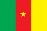
three equal vertical bands of green (hoist side), red, and yellow with a yellow five-pointed star centered in the red band; uses the popular pan-African colors of Ethiopia
Location
6 00 N, 12 00 E -- Western Africa, bordering the North Atlantic Ocean, between Equatorial Guinea and Nigeria Flag ----
Geography
Area
- comparative area
- slightly larger than California
- land area
- 469,440 sq km
- total area
- 475,440 sq km
Climate
varies with terrain, from tropical along coast to semiarid and hot in north
Coastline
402 km
Environment
- current issues
- water-borne diseases are prevalent; deforestation; overgrazing; desertification; poaching; overfishing
- international agreements
- party to - Biodiversity, Climate Change, Endangered Species, Law of the Sea, Ozone Layer Protection, Tropical Timber 83; signed, but not ratified - Desertification, Nuclear Test Ban, Tropical Timber 94
- natural hazards
- recent volcanic activity with release of poisonous gases
Geographic coordinates
6 00 N, 12 00 E
Geographic note
sometimes referred to as the hinge of Africa
International disputes
demarcation of international boundaries in vicinity of Lake Chad, the lack of which led to border incidents in the past, is completed and awaits ratification by Cameroon, Chad, Niger, and Nigeria; dispute with Nigeria over land and maritime boundaries in the vicinity of the Bakasi Peninsula has been referred to the International Court of Justice
Irrigated land
280 sq km (1989 est.)
Land boundaries
- border countries
- Central African Republic 797 km, Chad 1,094 km, Congo 523 km, Equatorial Guinea 189 km, Gabon 298 km, Nigeria 1,690 km
- total
- 4,591 km
Land use
- arable land
- 13%
- forest and woodland
- 54%
- meadows and pastures
- 18%
- other
- 13%
- permanent crops
- 2%
Location
Western Africa, bordering the North Atlantic Ocean, between Equatorial Guinea and Nigeria
Map references
Africa
Maritime claims
- territorial sea
- 50 nm
Natural resources
petroleum, bauxite, iron ore, timber, hydropower potential
Terrain
- diverse, with coastal plain in southwest, dissected plateau in center, mountains in west, plains in north
- highest point
- Fako 4,095 m
- lowest point
- Atlantic Ocean 0 m
People and Society
Age structure
0-14 years: 46% (male 3,295,924; female 3,266,429) 15-64 years: 51% (male 3,602,037; female 3,627,625) 65 years and over: 3% (male 213,176; female 256,366) (July 1996 est.)
Birth rate
42.49 births/1,000 population (1996 est.)
Death rate
13.56 deaths/1,000 population (1996 est.)
Ethnic divisions
Cameroon Highlanders 31%, Equatorial Bantu 19%, Kirdi 11%, Fulani 10%, Northwestern Bantu 8%, Eastern Nigritic 7%, other African 13%, non-African less than 1%
Infant mortality rate
78.7 deaths/1,000 live births (1996 est.)
Languages
24 major African language groups, English (official), French (official)
Life expectancy at birth
- female
- 53.68 years (1996 est.)
- male
- 51.55 years
- total population
- 52.6 years
Literacy
- age 15 and over can read and write (1995 est.)
- female
- 52.1%
- male
- 75%
- total population
- 63.4%
Nationality
- adjective
- Cameroonian
- noun
- Cameroonian(s)
Net migration rate
0 migrant(s)/1,000 population (1996 est.)
Population
14,261,557 (July 1996 est.)
Population growth rate
2.89% (1996 est.)
Religions
indigenous beliefs 51%, Christian 33%, Muslim 16%
Sex ratio
- all ages
- 1 male(s)/female (1996 est.)
- at birth
- 1.03 male(s)/female
- under 15 years
- 1.01 male(s)/female 15-64 years: 0.99 male(s)/female 65 years and over: 0.83 male(s)/female
Total fertility rate
5.99 children born/woman (1996 est.)
Government
Administrative divisions
10 provinces; Adamaoua, Centre, Est, Extreme-Nord, Littoral, Nord, Nord-Ouest, Ouest, Sud, Sud-Ouest
Capital
Yaounde
Constitution
20 May 1972
Data code
CM
Diplomatic representation in US
- chancery
- 2349 Massachusetts Avenue NW, Washington, DC 20008
- chief of mission
- Ambassador Jerome MENDOUGA
- telephone
- [1] (202) 265-8790 through 8794
Executive branch
- cabinet
- Cabinet appointed by the president
- chief of state
- President Paul BIYA (since 6 November 1982) elected for a five-year term by universal suffrage; election last held 11 October 1992 (next to be held NA October 1997); results - President Paul BIYA reelected with about 40% of the vote amid widespread allegations of fraud; SDF candidate John FRU NDI got 36% of the vote; UNDP candidate Bello Bouba MAIGARI got 19% of the vote
- head of government
- Prime Minister Simon ACHIDI ACHU (since 9 April 1992) appointed by the president
FAX
[237] 23-07-53
Flag
three equal vertical bands of green (hoist side), red, and yellow with a yellow five-pointed star centered in the red band; uses the popular pan-African colors of Ethiopia
Independence
1 January 1960 (from UN trusteeship under French administration)
International organization participation
ACCT, ACP, AfDB, BDEAC, CCC, CEEAC, ECA, FAO, FZ, G-19, G-77, IAEA, IBRD, ICAO, ICC, ICFTU, ICRM, IDA, IDB, IFAD, IFC, IFRCS, ILO, IMF, IMO, Inmarsat, Intelsat, Interpol, IOC, ITU, NAM, OAU, OIC, PCA, UDEAC, UN, UNCTAD, UNESCO, UNIDO, UPU, WCL, WFTU, WHO, WIPO, WMO, WToO, WTrO
Judicial branch
Supreme Court
Legal system
based on French civil law system, with common law influence; does not accept compulsory ICJ jurisdiction
Legislative branch
unicameral
Name of country
- conventional long form
- Republic of Cameroon
- conventional short form
- Cameroon
- former
- French Cameroon
National Assembly (Assemblee Nationale)
elections last held 1 March 1992 (next to be held NA March 1997); results - percent of vote by party NA; seats (180 total) CPDM 88, UNDP 68, UPC 18, MDR 6
National holiday
National Day, 20 May (1972)
Other political or pressure groups
Alliance for Change (FAC), Cameroon Anglophone Movement (CAM)
Political parties and leaders
- Cameroon People's Democratic Movement (CPDM) (government-controlled and the only party until legalization of opposition parties in 1990), Paul BIYA, president
- major opposition parties
- National Union for Democracy and Progress (UNDP); Social Democratic Front (SDF); Cameroonian Democratic Union (UDC); Union of Cameroonian Populations (UPC); Movement for the Defense of the Republic (MDR)
Suffrage
21 years of age; universal
Type of government
unitary republic; multiparty presidential regime (opposition parties legalized 1990)
US diplomatic representation
- chief of mission
- Ambassador Charles H. TWINING
- embassy
- Rue Nachtigal, Yaounde
- mailing address
- B. P. 817, Yaounde
- telephone
- [237] 23-40-14, 23-05-12
Economy
Agriculture
coffee, cocoa, cotton, rubber, bananas, oilseed, grains, root starches; livestock; timber
Budget
- expenditures
- $2.3 billion, including capital expenditures of $226 million (FY92/93 est.)
- revenues
- $1.6 billion
Currency
1 Communaute Financiere Africaine franc (CFAF) = 100 centimes
Economic aid
- recipient
- ODA, $449 million (1993)
Economic overview
- Because of its offshore oil resources and favorable agricultural conditions, Cameroon has one of the best-endowed, most diversified primary commodity economies in sub-Saharan Africa. Still, it faces many of the serious problems facing other underdeveloped countries, such as political instability, a top-heavy civil service, and a generally unfavorable climate for business enterprise. The development of the oil sector led to rapid economic growth between 1970 and 1985. Growth came to an abrupt halt in 1986, precipitated by steep declines in the prices
- of major exports
- coffee, cocoa, and petroleum. Export earnings were cut by almost one-third, and inefficiencies in fiscal management were exposed. In 1990-93, with support from the IMF and World Bank, the government began to introduce reforms designed to spur business investment, increase efficiency in agriculture, and recapitalize the nation's banks. Political instability, following suspect elections in 1992, brought IMF/WB structural adjustment to a halt; currently Cameroon receives only minimal assistance from those Bretton Woods institutions. Although the 50% devaluation of the currency of 12 January 1994 improved the potential for export growth, mismanagement remains the main barrier to economic improvement. The devaluation led to a spurt in inflation, to 48% in 1994, but inflation moderated in 1995. Progress toward privatization of remaining state industry remains slow.
Electricity
- capacity
- 630,000 kW
- consumption per capita
- 196 kWh (1993)
- production
- 2.7 billion kWh
Exchange rates
- CFA francs (CFAF) per US$1 - 500.56 (January 1996), 499.15 (1995), 555.20 (1994), 283.16 (1993), 264.69 (1992), 282.11 (1991)
- note
- beginning 12 January 1994, the CFA franc was devalued to CFAF 100 per French franc from CFAF 50 at which it had been fixed since 1948
Exports
- $1.2 billion (f.o.b., 1994)
- commodities
- crude oil and petroleum products, lumber, aluminum, cocoa beans, coffee, cotton
- partners
- EU (particularly France) about 50%, African countries, US
External debt
$6.6 billion (1993)
Fiscal year
1 July - 30 June
GDP
purchasing power parity - $16.5 billion (1995 est.)
GDP composition by sector
- agriculture
- 29%
- industry
- 24%
- services
- 47% (1994 est.)
GDP per capita
$1,200 (1995 est.)
GDP real growth rate
1.8% (1995 est.)
Imports
- $810 million (f.o.b., 1994)
- commodities
- machines and electrical equipment, food, consumer goods, transport equipment, petroleum products
- partners
- EU (France 38%, Germany), African countries, Japan 5%, US 5%
Industrial production growth rate
NA%
Industries
petroleum production and refining, food processing, light consumer goods, textiles, lumber
Inflation rate (consumer prices)
48% (1994)
Labor force
- NA
- by occupation
- agriculture 74.4%, industry and transport 11.4%, other services 14.2% (1983)
Unemployment rate
NA%
Communications
Branches
Army, Navy (includes Naval Infantry), Air Force, National Gendarmerie, Presidential Guard
Defense expenditures
exchange rate conversion - $102 million, NA% of GDP (FY93/94)
Manpower availability
- males age 15-49
- 3,112,339
- males fit for military service
- 1,572,150
- males reach military age (18) annually
- 151,300 (1996 est.)
Radio broadcast stations
AM 11, FM 11, shortwave 0
Radios
2 million (1993 est.)
Telephone system
- available only to business and government
- domestic
- cable, microwave radio relay, and tropospheric scatter
- international
- satellite earth stations - 2 Intelsat (Atlantic Ocean)
Telephones
36,737 (1991 est.)
Television broadcast stations
1 (1995)
Televisions
NA Defense
Transportation
Airports
- total
- 45
- with paved runways 1 524 to 2 437 m
- 3
- with paved runways 2 438 to 3 047 m
- 4
- with paved runways 914 to 1 523 m
- 1
- with paved runways over 3 047 m
- 2
- with paved runways under 914 m
- 13
- with unpaved runways 1 524 to 2 437 m
- 7
- with unpaved runways 914 to 1 523 m
- 15 (1995 est.)
Highways
- paved
- 2,666 km
- total
- 64,626 km
- unpaved
- 61,960 km (1987 est.)
Merchant marine
- total
- 2 cargo ships (1,000 GRT or over) totaling 24,122 GRT/33,509 DWT (1995 est.)
Ports
Bonaberi, Douala, Garoua, Kribi, Tiko
Railways
- narrow gauge
- 1,104 km 1.000-m gauge
- total
- 1,104 km (1995 est.)
Waterways
2,090 km; of decreasing importance