1989 Edition
CIA World Factbook 1989 (Internet Archive)
Geography
Administrative divisions
24 states (estados, singular — estado), 2 territories* (territories, singular — territorio), and 1 federal district** (distrito federal); Acre, Alagoas, Amapa*, Amazonas, Bahia, Ceara, Distrito Federal**, Espirito Santo, Goias, Maranhao, Mato Grosso, Mato Grosso do Sul, Minas Gerais, Para, Paraiba, Parana, Pernambuco, Piaui, Rio de Janeiro, Rio Grande do Norte, Rio Grande do Sul, Rondonia, Roraima*, Santa Catarina, Sao Paulo, Sergipe, Tocantins; note — the territories of Amapa and Roraima will become states on 1 5 March 1991
Capital
Brasilia
Climate
- antarctic
- mostly tropical, but temperate in south
Coastline
- 29.6 km
- 7,491 km
Communists
about 30,000
Comparative area
- about 0.3 times the size of Washington, DC
- slightly smaller than the US
Constitution
5 October 1988
Contiguous zone
10 nm
Continental shelf
- 200 meters or to depth of exploitation
- 200 meters or to depth of exploitation
Diplomatic representation
Ambassador Marcilio Marques MOREIRA; Chancery at 3006 Massachusetts Avenue NW, Washington DC 20008; telephone (202) 745-2700; there are Brazilian Consulates General in Atlanta, Chicago, Los Angeles, Miami, New Orleans, and New York, and Consulates in Dallas, Houston, and San Francisco; US — Ambassador Richard MELTON; Embassy at Avenida das Nocoes, Lote 3, Brasilia, Distrito Federal (mailing address is APO Miami 34030); telephone [55] (6) 321-7272; there are US Consulates General in Rio de Janeiro and Sao Paulo, and Consulates in Porto Alegre and Recife
Disputes
short section of the boundary with Paraguay (just west of Guaira Falls on the Rio Parana) is in dispute; two short sections of boundary with Uruguay are in dispute (Arroyo de la Invernada area of the Rio Quarai and the islands at the confluence of the Rio Quarai and the Uruguay); claims a Zone of Interest in Antarctica
Elections
President — last held 15 November 1989, with runoff on 17 December 1989 (next to be held November 1994); results — Fernando Collor de Mello 53%, Luis Inacio da Silva 47%; first free, direct presidential election since 1960; Senate— last held 15 November 1986 (next to be held 3 October 1990); results — PMDB 60%, PFL 21%, PDS 8%, PDT 3%, others 8%; seats— (66 total) PMDB 43, PFL 15, PDS 6, PDT 2, others 6; note — as of 1990 Senate has 75 seats; Chamber of Deputies — last held 1 5 November 1986 (next to be held 3 October 1990); results— PMDB 53%, PFL 23%, PDS 7%, PDT 5%, other 12%; seats— (495 total) PMDB 258, PFL 114, PDS 33, PDT 24, others 58; note— as of 1990 Chamber of Deputies has 570 seats
Environment
- covered by glacial ice
- recurrent droughts in northeast; floods and frost in south; deforestation in Amazon basin; air and water pollution in Rio de Janeiro and Sao Paulo
Exclusive fishing zone
200 nm
Executive branch
president, vice president, Cabinet
Extended economic zone
200 nm
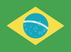
Flag
green with a large yellow diamond in the center bearing a blue celestial globe with 23 white five-pointed stars (one for each state) arranged in the same pattern as the night sky over Brazil; the globe has a white equatorial band with the motto ORDEM E PROGRESSO (Order and Progress)
Independence
7 September 1822 (from Portugal)
Judicial branch
Supreme Federal Tribunal
Land boundaries
- none
- 14,691 km total; Argentina 1,224 km, Bolivia 3,400 km, Colombia 1,643 km, French Guiana 673 km, Guyana 1,1 19 km, Paraguay 1,290 km, Peru 1,560 km, Suriname 597 km, Uruguay 985 km, Venezuela 2,200 km
Land use
- 0% arable land; 0% permanent crops; 0% meadows and pastures; 0% forest and woodland; 100% other
- 7% arable land; 1 % permanent crops; 19% meadows and pastures; 67% forest and woodland; 6% other; includes NEGL% irrigated
Leaders
Chief of State and Head of Government— President Fernando Affonso COLLOR de Mello (since 15 March 1990); Vice President Itamar FRANCO (since 15 March 1990) Political parties and leaders: National Reconstruction Party (PRN), Daniel Tourinho, president; Brazilian Democratic Movement Party (PMDB), Ulysses Guimaraes, president; Liberal Front Party (PFL), Hugo Napoleao, president; Workers' Party (PT), Luis Ignacio (Lula) da Silva, president; Brazilian Labor Party (PTB), Luiz Gonzaga de Paiva Muniz, president; Democratic Labor Party (PDT), Doutel de Andrade, president; Democratic Social Party (PDS), Jarbas Passarinho, president; Brazilian Social Democracy Party (PSDB), Mario Covas, president; Brazilian Communist Party (PCB), Salomao Malina, secretary general; Communist Party of Brazil (PCdoB), Joao Amazonas, president
Legal system
based on Latin codes; has not accepted compulsory ICJ jurisdiction
Legislative branch
bicameral National Congress (Congresso Nacional) consists of an upper chamber or Senate (Senado) and a lower chamber or Chamber of Deputies (Camara dos Deputados)
Member of
CCC, FAO, G-77, GATT, Group of Eight, IADB, IAEA, IBRD, ICAC, ICAO, ICO, IDA, IDB— InterAmerican Development Bank, I FAD, IFC, IHO, ILO, IMF, IMO, INTELSAT, IPU, IRC, ISO, ITU, IWC— International Wheat Council, OAS, PAHO, SELA, UN, UNESCO, UPU, WHO, WIPO, WMO, WTO
National holiday
Independence Day, 7 September (1822)
Natural resources
- none
- iron ore, manganese, bauxite, nickel, uranium, phosphates, tin, hydropower, gold, platinum, crude oil, timber
Note
- located in the South Atlantic Ocean 2,575 km south-southwest of the Cape of Good Hope, South Africa
- largest country in South America; shares common boundaries with every South American country except Chile and
Other political or pressure groups
left wing of the Catholic Church and labor unions allied to leftist Worker's Party are critical of government's social and economic policies
Suffrage
voluntary at age 16; compulsory between ages 1 8 and 70; voluntary at age
Terrain
- volcanic; maximum elevation about 800 meters; coast is mostly inacessible
- mostly flat to rolling lowlands in north; some plains, hills, mountains, and narrow coastal belt
Territorial sea
- 4 nm
- 200 nm
Total area
- 58 km2; land area: 58 km2
- 8,51 1,965 km2; land area: 8,456,510 km2; includes Arquipelago de Fernando de Noronha, Atol das Rocas, Ilha da Trindade, Ilhas Martin Vaz, and Penedos de S3o Pedro e Sao Paulo
Total area
2 km South Atlantic Ocean S« retion>l mip XII
Type
federal republic
People and Society
Population
uninhabited
Government
Long-form name
none
Type
territory of Norway
Economy
Agriculture
accounts for 12% of GDP; world's largest producer and exporter of coffee and orange juice concentrate and second-largest exporter of soybeans; other products — rice, corn, sugarcane, cocoa, beef; self-sufficient in food, except for wheat
Aid
US commitments, including Ex-Im (FY70-88), $2.5 billion; Western (non-US) countries, ODA and OOF bilateral commitments (1970-87), $9.5 billion; OPEC bilateral aid (1979-89), $284 million; Communist countries (1970-88), $1.3 billion
Budget
revenues $27.8 billion; expenditures $40. 1 billion, including capital expenditures of $8.8 billion (1986)
Currency
novo cruzado (plural — novos cruzados); 1 novo cruzado (NCr$) = 100 centavos
Electricity
52,865,000 kW capacity; 202,280 million kWh produced, 1,340 kWh per capita (1989)
Exchange rates
novos cruzados (NCr$) per US$1— 2.83392 (1989), 0.26238 (1988), 0.03923 (1987), 0.01366 (1986), 0.00620 (1985); note— 25 tourist/parallel rate (December 1989)
Exports
$34.2 billion (1989 est.); commodities— coffee, metallurgical products, chemical products, foodstuffs, iron ore, automobiles and parts; partners — US 28%, EC 26%, Latin America 1 1%, Japan 6% (1987)
External debt
$109 billion (December 1989)
Fiscal year
calendar year
GDP
$377 billion, per capita $2,500; real growth rate 3% (1989 est.)
Illicit drugs
illicit producer of cannabis and coca, mostly for domestic consumption; government has an active eradication program to control cannabis and coca cultivation
Imports
$18.0 billion (1989 est.); commodities—crude oil, capital goods, chemical products, foodstuffs, coal; partners — Middle East and Africa 24%, EC 22%, US 21%, Latin America 12%, Japan 6% (1987)
Industrial production
growth rate 3.2% (1989 est.)
Industries
textiles and other consumer goods, shoes, chemicals, cement, lumber, iron ore, steel, motor vehicles and auto parts, metalworking, capital goods, tin
Inflation rate (consumer prices)
1 ,765% (1989)
Overview
- no economic activity
- The economy, a mixture of private enterprises of all sizes and extensive government intervention, experienced enormous difficulties in the late 1980s, notably declining real growth, runaway inflation, foreign debt obligations of more than $100 billion, and uncertain economic policy. Government intervention includes trade and investment restrictions, wage/ price controls, interest and exchange rate controls, and extensive tariff barriers. Ownership of major industrial facilities is divided among private interests, the government, and multinational companies. Ownership in agriculture likewise is varied, with the government intervening in the politically sensitive issues involving large landowners and the masses of poor peasants. In consultation with the IMF, the Brazilian Government has initiated several programs over the last few years to ameliorate the stagnation and foreign debt problems. None of these has given more than temporary relief. The strategy of the new Collor government is to increase the pace of privatization, encourage foreign trade and investment, and establish a more realistic exchange rate. One long-run strength is the existence of vast natural resources.
Unemployment rate
2.5% (December 1989) Brazil (continued)
Communications
Highways
1,448,000 km total; 48,000 km paved, 1,400,000 km gravel or earth
Inland waterways
50,000 km navigable
Note
defense is the responsibility of Norway North Atlantic Ocean Sao Luis de Janeiro 'Sio Paulo South Atlantic Ocean Porto Aleqre S« rtfional map IV
Ports
none; offshore anchorage only
Railroads
29,694 km total; 25,268 km 1.000-meter gauge, 4,339 km 1.600-meter gauge, 74 km mixed 1.600-1.000-meter gauge, 13 km 0.760-meter gauge; 2,308 km electrified
Telecommunications
automatic meteorological station Defense Forces