2003 Edition
CIA World Factbook 2003 (Project Gutenberg)
Introduction
Area
- land
- 58.5 sq km
- total
- 58.5 sq km
- water
- 0 sq km
Area - comparative
about 0.3 times the size of Washington, DC
Background
This uninhabited volcanic island is almost entirely covered by glaciers and is difficult to approach. It was discovered in 1739 by a French naval officer after whom the island was named. No claim was made until 1825, when the British flag was raised. In 1928, the UK waived its claim in favor of Norway, which had occupied the island the previous year. In 1971, Bouvet Island and the adjacent territorial waters were designated a nature reserve. Since 1977, Norway has run an automated meteorological station on the island. Geography Bouvet Island
Climate
antarctic
Coastline
29.6 km
Communications - note
automatic meteorological station Transportation Bouvet Island
Country name
- conventional long form
- none
- conventional short form
- Bouvet Island
Dependency status
territory of Norway; administered by the Polar Department of the Ministry of Justice and Police from Oslo
Disputes - international
none This page was last updated on 18 December, 2003
Economy - overview
no economic activity; declared a nature reserve Communications Bouvet Island
Elevation extremes
- highest point
- Olav Peak 935 m
- lowest point
- South Atlantic Ocean 0 m
Environment - current issues
NA
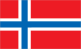
Flag description
the flag of Norway is used Economy Bouvet Island
Geographic coordinates
54 26 S, 3 24 E
Geography - note
covered by glacial ice; declared a nature reserve People Bouvet Island
Internet country code
.bv
Irrigated land
0 sq km (1998 est.)
Land boundaries
0 km
Land use
- arable land
- 0%
- other
- 100% (93% ice) (1998 est.)
- permanent crops
- 0%
Legal system
the laws of Norway, where applicable, apply
Location
island in the South Atlantic Ocean, southwest of the Cape of Good Hope (South Africa)
Map references
Antarctic Region
Maritime claims
- territorial sea
- 4 NM
Military - note
defense is the responsibility of Norway Transnational Issues Bouvet Island
Natural hazards
NA
Natural resources
none
Population
uninhabited (July 2003 est.) Government Bouvet Island
Ports and harbors
none; offshore anchorage only Military Bouvet Island
Terrain
volcanic; coast is mostly inaccessible
Waterways
none