2008 Edition
CIA World Factbook 2008 (Project Gutenberg)
Introduction
Background
In 1865, Britain and Bhutan signed the Treaty of Sinchulu, under which Bhutan would receive an annual subsidy in exchange for ceding some border land to British India. Under British influence, a monarchy was set up in 1907; three years later, a treaty was signed whereby the British agreed not to interfere in Bhutanese internal affairs and Bhutan allowed Britain to direct its foreign affairs. This role was assumed by independent India after 1947. Two years later, a formal Indo-Bhutanese accord returned the areas of Bhutan annexed by the British, formalized the annual subsidies the country received, and defined India's responsibilities in defense and foreign relations. A refugee issue of over 100,000 Bhutanese in Nepal remains unresolved; 90% of the refugees are housed in seven United Nations Office of the High Commissioner for Refugees (UNHCR) camps. In March 2005, King Jigme Singye WANGCHUCK unveiled the government's draft constitution - which would introduce major democratic reforms - and pledged to hold a national referendum for its approval. In December 2006, the King abdicated the throne to his son, Jigme Khesar Namgyel WANGCHUCK, in order to give him experience as head of state before the democratic transition. In early 2007, India and Bhutan renegotiated their treaty to allow Bhutan greater autonomy in conducting its foreign policy, although Thimphu continues to coordinate policy decisions in this area with New Delhi. In July 2007, seven ministers of Bhutan's ten-member cabinet resigned to join the political process, and the cabinet acted as a caretaker regime until democratic elections for seats to the country's first parliament were completed in March 2008. The king ratified the country's first constitution in July 2008.
Geography
Area
total: 47,000 sq km land: 47,000 sq km water: 0 sq km
Area - comparative
about one-half the size of Indiana
Climate
varies; tropical in southern plains; cool winters and hot summers in central valleys; severe winters and cool summers in Himalayas
Coastline
0 km (landlocked)
Elevation extremes
lowest point: Drangme Chhu 97 m highest point: Kula Kangri 7,553 m
Environment - current issues
soil erosion; limited access to potable water
Environment - international agreements
party to: Biodiversity, Climate Change, Climate Change-Kyoto Protocol, Desertification, Endangered Species, Hazardous Wastes signed, but not ratified: Law of the Sea
Freshwater withdrawal (domestic/industrial/agricultural)
total: 0.43 cu km/yr (5%/1%/94%) per capita: 199 cu m/yr (2000)
Geographic coordinates
27 30 N, 90 30 E
Geography - note
landlocked; strategic location between China and India; controls several key Himalayan mountain passes
Irrigated land
400 sq km (2003)
Land boundaries
total: 1,075 km border countries: China 470 km, India 605 km
Land use
arable land: 2.3% permanent crops: 0.43% other: 97.27% (2005)
Location
Southern Asia, between China and India
Map references
Asia
Maritime claims
none (landlocked)
Natural hazards
violent storms from the Himalayas are the source of the country's name, which translates as Land of the Thunder Dragon; frequent landslides during the rainy season
Natural resources
timber, hydropower, gypsum, calcium carbonate
Terrain
mostly mountainous with some fertile valleys and savanna
Total renewable water resources
95 cu km (1987)
People and Society
Age structure
0-14 years: 30.8% (male 107,360/female 103,093) 15-64 years: 63.7% (male 231,323/female 203,649) 65 years and over: 5.4% (male 19,561/female 17,335) (2008 est.)
Birth rate
20.56 births/1,000 population (2008 est.)
Death rate
7.54 deaths/1,000 population (2008 est.)
Education expenditures
7% of GDP (2005)
Ethnic groups
Bhote 50%, ethnic Nepalese 35% (includes Lhotsampas - one of several Nepalese ethnic groups), indigenous or migrant tribes 15%
HIV/AIDS - adult prevalence rate
less than 0.1% (2001 est.)
HIV/AIDS - deaths
NA
HIV/AIDS - people living with HIV/AIDS
fewer than 100 (1999 est.)
Infant mortality rate
total: 51.92 deaths/1,000 live births male: 53.1 deaths/1,000 live births female: 50.69 deaths/1,000 live births (2008 est.)
Languages
Dzongkha (official), Bhotes speak various Tibetan dialects, Nepalese speak various Nepalese dialects
Life expectancy at birth
total population: 65.53 years male: 64.75 years female: 66.35 years (2008 est.)
Literacy
definition: age 15 and over can read and write total population: 47% male: 60% female: 34% (2003 est.)
Major infectious diseases
degree of risk: intermediate food or waterborne diseases: bacterial and protozoal diarrhea, hepatitis A, and typhoid fever vectorborne diseases: malaria water contact disease: leptospirosis (2008)
Median age
total: 23.5 years male: 24.1 years female: 22.8 years (2008 est.)
Nationality
noun: Bhutanese (singular and plural) adjective: Bhutanese
Net migration rate
NA (2008 est.)
Population
682,321 note: the Factbook population estimate is consistent with the first modern census of Bhutan, conducted in 2005; previous Factbook population estimates for this country, which were on the order of three times the total population reported here, were based on Bhutanese government publications that did not include the census (July 2008 est.)
Population growth rate
1.301% (2008 est.)
Religions
Lamaistic Buddhist 75%, Indian- and Nepalese-influenced Hinduism 25%
School life expectancy (primary to tertiary education)
total: 10 years male: 11 years female: 10 years (2006)
Sex ratio
at birth: 1.05 male(s)/female under 15 years: 1.04 male(s)/female 15-64 years: 1.14 male(s)/female 65 years and over: 1.13 male(s)/female total population: 1.1 male(s)/female (2008 est.)
Total fertility rate
2.48 children born/woman (2008 est.)
Government
Administrative divisions
20 districts (dzongkhag, singular and plural); Bumthang, Chhukha, Chirang, Daga, Gasa, Geylegphug, Ha, Lhuntshi, Mongar, Paro, Pemagatsel, Punakha, Samchi, Samdrup Jongkhar, Shemgang, Tashigang, Tashi Yangtse, Thimphu, Tongsa, Wangdi Phodrang
Capital
name: Thimphu geographic coordinates: 27 29 N, 89 36 E time difference: UTC+6 (11 hours ahead of Washington, DC during Standard Time)
Constitution
ratified 23 July 2008
Country name
conventional long form: Kingdom of Bhutan conventional short form: Bhutan local long form: Druk Gyalkhap local short form: Druk Yul
Diplomatic representation from the US
the US and Bhutan have no formal diplomatic relations, although informal contact is maintained between the Bhutanese and US Embassy in New Delhi (India)
Diplomatic representation in the US
none; note - the Permanent Mission to the UN for Bhutan has consular jurisdiction in the US; address: 763 First Avenue, New York, NY 10017; telephone [1] (212) 682-2268; FAX [1] (212) 661-0551 consulate(s) general: New York
Executive branch
chief of state: King Jigme Khesar Namgyel WANGCHUCK (since 14 December 2006); note - King Jigme Singye WANGCHUCK abdicated the throne on 14 December 2006 and his son immediately succeeded him head of government: Prime Minister Jigme THINLEY (since 9 April 2008) cabinet: Council of Ministers (Lhengye Shungtsog) nominated by the monarch, approved by the National Assembly; members serve fixed, five-year terms; note - there is also a Royal Advisory Council (Lodoi Tsokde), members nominated by the monarch elections: the monarch is hereditary, but democratic reforms in July 1998 grant the National Assembly authority to remove the monarch with two-thirds vote; election of a new National Assembly occurred in March 2008; the leader of the majority party is nominated as the prime minister
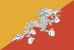
Flag description
divided diagonally from the lower hoist-side corner; the upper triangle is yellow and the lower triangle is orange; centered along the dividing line is a large black and white dragon facing away from the hoist side
Government type
in transition to constitutional monarchy; special treaty relationship with India
Independence
1907 (became a unified kingdom under its first hereditary king)
International organization participation
ADB, BIMSTEC, CP, FAO, G-77, IBRD, ICAO, IDA, IFAD, IFC, IMF, Interpol, IOC, IOM (observer), ISO (correspondent), ITSO, ITU, NAM, OPCW, SAARC, SACEP, UN, UNCTAD, UNESCO, UNIDO, UNWTO, UPU, WCO, WFTU, WHO, WIPO, WMO, WTO (observer)
Judicial branch
Supreme Court of Appeal (the monarch); High Court (judges appointed by the monarch); note - the draft constitution establishes a Supreme Court, which will serve as chief court of appeal
Legal system
based on Indian law and English common law; has not accepted compulsory ICJ jurisdiction
Legislative branch
new bicameral Parliament consists of the non-partisan National Council (25 seats; 20 members elected by each of the 20 electoral districts (dzongkhags) for four-year terms and 5 members nominated by the King); and the National Assembly (47 seats; members elected by direct, popular vote for five-year terms) elections: National Council elections last held on 31 December 2007 and 29 January 2008 (next to be held by December 2012); National Assembly elections last held on 24 March 2008 (next to be held by March 2013) election results: National Council - NA; National Assembly - percent of vote by party - DPT 67%, PDP 33%; seats by party - DPT 45, PDP 2
National holiday
National Day (Ugyen WANGCHUCK became first hereditary king), 17 December (1907)
Political parties and leaders
Bhutan Peace and Prosperity Party (Druk Phuensum Tshogpa) or DPT [Jigme THINLEY]; People's Democratic Party or PDP [Sangay NGEDUP]
Political pressure groups and leaders
United Front for Democracy (exiled) other: Buddhist clergy; ethnic Nepalese organizations leading militant antigovernment campaign; Indian merchant community
Suffrage
18 years of age; universal
Economy
Agriculture - products
rice, corn, root crops, citrus, foodgrains; dairy products, eggs
Budget
revenues: $272 million expenditures: $350 million note: the government of India finances nearly three-fifths of Bhutan's budget expenditures (2005)
Commercial bank prime lending rate
14% (31 December 2007)
Currency (code)
ngultrum (BTN); Indian rupee (INR)
Currency code
BTN; INR
Current account balance
$116 million (2007 est.)
Debt - external
$713.3 million (2006)
Economic aid - recipient
$941.2 million; note - substantial aid from India (2006)
Economy - overview
The economy, one of the world's smallest and least developed, is based on agriculture and forestry, which provide the main livelihood for more than 60% of the population. Agriculture consists largely of subsistence farming and animal husbandry. Rugged mountains dominate the terrain and make the building of roads and other infrastructure difficult and expensive. The economy is closely aligned with India's through strong trade and monetary links and dependence on India's financial assistance. The industrial sector is technologically backward, with most production of the cottage industry type. Most development projects, such as road construction, rely on Indian migrant labor. Model education, social, and environment programs are underway with support from multilateral development organizations. Each economic program takes into account the government's desire to protect the country's environment and cultural traditions. For example, the government, in its cautious expansion of the tourist sector, encourages visits by upscale, environmentally conscientious tourists. Detailed controls and uncertain policies in areas such as industrial licensing, trade, labor, and finance continue to hamper foreign investment. Hydropower exports to India had a major impact on growth in 2007.
Electricity - consumption
528.8 million kWh (2007 est.)
Electricity - exports
3.644 billion kWh (2007 est.)
Electricity - imports
11 million kWh (2007 est.)
Electricity - production
4.475 billion kWh (2007 est.)
Electricity - production by source
fossil fuel: 0.1% hydro: 99.9% nuclear: 0% other: 0% (2001)
Exchange rates
ngultrum (BTN) per US dollar - 41.487 (2007), 45.279 (2006), 44.101 (2005), 45.317 (2004), 46.583 (2003) note: the ngultrum is pegged to the Indian rupee
Exports
$350 million f.o.b. (2006)
Exports - commodities
electricity (to India), cardamom, gypsum, timber, handicrafts, cement, fruit, precious stones, spices
Exports - partners
India 58.6%, Hong Kong 30.1%, Bangladesh 7.3% (2007)
Fiscal year
1 July - 30 June
GDP - composition by sector
agriculture: 22.3% industry: 37.9% services: 39.8% (2006)
GDP - per capita (PPP)
$5,200 (2007 est.)
GDP - real growth rate
22.4% (2007 est.)
GDP (official exchange rate)
$1.308 billion (2007 est.)
GDP (purchasing power parity)
$3.359 billion (2007 est.)
Household income or consumption by percentage share
lowest 10%: NA% highest 10%: NA%
Imports
$320 million c.i.f. (2006)
Imports - commodities
fuel and lubricants, grain, aircraft, machinery and parts, vehicles, fabrics, rice
Imports - partners
India 74.5%, Japan 7.4%, Sweden 3.2% (2007)
Industrial production growth rate
9.3% (1996 est.)
Industries
cement, wood products, processed fruits, alcoholic beverages, calcium carbide, tourism
Inflation rate (consumer prices)
4.9% (2007 est.)
Labor force
NA note: major shortage of skilled labor
Labor force - by occupation
agriculture: 63% industry: 6% services: 31% (2004 est.)
Market value of publicly traded shares
$NA
Natural gas - consumption
0 cu m (2007 est.)
Natural gas - exports
0 cu m (2007 est.)
Natural gas - imports
0 cu m (2007 est.)
Natural gas - production
0 cu m (2007 est.)
Natural gas - proved reserves
0 cu m (1 January 2006 est.)
Oil - consumption
1,250 bbl/day (2006 est.)
Oil - exports
0 bbl/day (2005)
Oil - imports
1,152 bbl/day (2005)
Oil - production
0 bbl/day (2007 est.)
Oil - proved reserves
0 bbl (1 January 2006 est.)
Population below poverty line
31.7% (2003)
Public debt
81.4% of GDP (2004)
Stock of domestic credit
$169.9 million (31 December 2007)
Stock of money
$381.1 million (31 December 2007)
Stock of quasi money
$220.3 million (31 December 2007)
Unemployment rate
2.5% (2004)
Communications
Internet country code
.bt
Internet hosts
9,046 (2008)
Internet Service Providers (ISPs)
NA
Internet users
40,000 (2007)
Radio broadcast stations
AM 0, FM 9, shortwave 1 (2007)
Radios
37,000 (1997)
Telephone system
general assessment: urban towns and district headquarters have telecommunications services domestic: very low teledensity; domestic service is very poor especially in rural areas; wireless service available since 2003 international: country code - 975; international telephone and telegraph service via landline and microwave relay through India; satellite earth station - 1 Intelsat (2007)
Telephones - main lines in use
29,900 (2007)
Telephones - mobile cellular
149,400 (2007)
Television broadcast stations
1 (2007)
Televisions
11,000 (1997)
Transportation
Airports
2 (2007)
Airports - with paved runways
total: 1 1,524 to 2,437 m: 1 (2007)
Airports - with unpaved runways
total: 1 914 to 1,523 m: 1 (2007)
Roadways
total: 8,050 km paved: 4,991 km unpaved: 3,059 km (2003)
Military and Security
Manpower available for military service
males age 16-49: 190,104 females age 16-49: 167,289 (2008 est.)
Manpower fit for military service
males age 16-49: 146,063 females age 16-49: 131,193 (2008 est.)
Manpower reaching militarily significant age annually
male: 7,847 female: 7,530 (2008 est.)
Military branches
Royal Bhutan Army (includes Royal Bodyguard and Royal Bhutan Police) (2008)
Military expenditures
1% of GDP (2005 est.)
Military service age and obligation
18 years of age for voluntary military service; no conscription (2008)
Transnational Issues
Disputes - international
Bhutan cooperates with India to expel Indian Nagaland separatists; lacking any treaty describing the boundary, Bhutan and China continue negotiations to establish a common boundary alignment to resolve territorial disputes arising from substantial cartographic discrepancies, the largest of which lie in Bhutan's northwest and along the Chumbi salient This page was last updated on 18 December, 2008