2021 Edition
CIA World Factbook 2021 (factbook.json @ e0d5604b9e27)
Introduction
Background
Present day Benin was the site of Dahomey, a West African kingdom that rose to prominence in about 1600 and over the next two and a half centuries became a regional power, largely based on its slave trade. France began to control the coastal areas of Dahomey in the second half of the 19th century; the entire kingdom was conquered by 1894. French Dahomey achieved independence in 1960; it changed its name to the Republic of Benin in 1975. A succession of military governments ended in 1972 with the rise to power of Mathieu KEREKOU and the establishment of a government based on Marxist-Leninist principles. A move to representative government began in 1989. Two years later, free elections ushered in former Prime Minister Nicephore SOGLO as president, marking the first successful transfer of power in Africa from a dictatorship to a democracy. KEREKOU was returned to power by elections held in 1996 and 2001, though some irregularities were alleged. KEREKOU stepped down at the end of his second term in 2006 and was succeeded by Thomas YAYI Boni, a political outsider and independent, who won a second five-year term in March 2011. Patrice TALON, a wealthy businessman, took office in 2016 after campaigning to restore public confidence in the government.
Geography
Area
- land
- 110,622 sq km
- total
- 112,622 sq km
- water
- 2,000 sq km
Area - comparative
slightly smaller than Pennsylvania
Climate
tropical; hot, humid in south; semiarid in north
Coastline
121 km
Elevation
- highest point
- Mont Sokbaro 658 m
- lowest point
- Atlantic Ocean 0 m
- mean elevation
- 273 m
Geographic coordinates
9 30 N, 2 15 E
Geography - note
sandbanks create difficult access to a coast with no natural harbors, river mouths, or islands
Irrigated land
230 sq km (2012)
Land boundaries
- border countries
- Burkina Faso 386 km, Niger 277 km, Nigeria 809 km, Togo 651 km
- total
- 2,123 km
Land use
- agricultural land
- 31.3% (2018 est.)
- agricultural land: arable land
- arable land: 22.9% (2018 est.)
- agricultural land: permanent crops
- permanent crops: 3.5% (2018 est.)
- agricultural land: permanent pasture
- permanent pasture: 4.9% (2018 est.)
- forest
- 40% (2018 est.)
- other
- 28.7% (2018 est.)
Location
Western Africa, bordering the Bight of Benin, between Nigeria and Togo
Major watersheds (area sq km)
Atlantic Ocean drainage: Niger (2,261,741 sq km), Volta (410,991 sq km)
Map references
Africa
Maritime claims
- continental shelf
- 200 nm
- exclusive fishing zone
- 200 nm
- territorial sea
- 200 nm; note: the US does not recognize this claim
Natural hazards
hot, dry, dusty harmattan wind may affect north from December to March
Natural resources
small offshore oil deposits, limestone, marble, timber
Population distribution
the population is primarily located in the south, with the highest concentration of people residing in and around the cities on the Atlantic coast; most of the north remains sparsely populated with higher concentrations of residents in the west at shown in this population distribution map
Terrain
mostly flat to undulating plain; some hills and low mountains
People and Society
Age structure
- 0-14 years
- 45.56% (male 2,955,396/female 2,906,079)
- 15-24 years
- 20.36% (male 1,300,453/female 1,318,880)
- 25-54 years
- 28.54% (male 1,735,229/female 1,935,839)
- 55-64 years
- 3.15% (male 193,548/female 211,427)
- 65 years and over
- 2.39% (male 140,513/female 167,270) (2020 est.)
Birth rate
41.55 births/1,000 population (2021 est.)
Children under the age of 5 years underweight
16.8% (2017/18)
Contraceptive prevalence rate
15.5% (2017/18)
Current Health Expenditure
2.5% (2018)
Death rate
8.21 deaths/1,000 population (2021 est.)
Demographic profile
Benin has a youthful age structure – almost 65% of the population is under the age of 25 – which is bolstered by high fertility and population growth rates. Benin’s total fertility has been falling over time but remains high, declining from almost 7 children per women in 1990 to 4.8 in 2016. Benin’s low contraceptive use and high unmet need for contraception contribute to the sustained high fertility rate. Although the majority of Beninese women use skilled health care personnel for antenatal care and delivery, the high rate of maternal mortality indicates the need for more access to high quality obstetric care.Poverty, unemployment, increased living costs, and dwindling resources increasingly drive the Beninese to migrate. An estimated 4.4 million, more than 40%, of Beninese live abroad. Virtually all Beninese emigrants move to West African countries, particularly Nigeria and Cote d’Ivoire. Of the less than 1% of Beninese emigrants who settle in Europe, the vast majority live in France, Benin’s former colonial ruler.With about 40% of the population living below the poverty line, many desperate parents resort to sending their children to work in wealthy households as domestic servants (a common practice known as vidomegon), mines, quarries, or agriculture domestically or in Nigeria and other neighboring countries, often under brutal conditions. Unlike in other West African countries, where rural people move to the coast, farmers from Benin’s densely populated southern and northwestern regions move to the historically sparsely populated central region to pursue agriculture. Immigrants from West African countries came to Benin in increasing numbers between 1992 and 2002 because of its political stability and porous borders.
Dependency ratios
- elderly dependency ratio
- 6
- potential support ratio
- 16.7 (2020 est.)
- total dependency ratio
- 82.6
- youth dependency ratio
- 76.6
Drinking water source
- improved: rural
- rural: 72.2% of population
- improved: total
- total: 76.4% of population
- improved: urban
- urban: 81.2% of population
- unimproved: rural
- rural: 27.8% of population
- unimproved: total
- total: 23.6% of population (2017 est.)
- unimproved: urban
- urban: 18.8% of population
Education expenditures
3% of GDP (2019)
Ethnic groups
Fon and related 38.4%, Adja and related 15.1%, Yoruba and related 12%, Bariba and related 9.6%, Fulani and related 8.6%, Ottamari and related 6.1%, Yoa-Lokpa and related 4.3%, Dendi and related 2.9%, other 0.9%, foreigner 1.9% (2013 est.)
HIV/AIDS - adult prevalence rate
0.9% (2020 est.)
HIV/AIDS - deaths
2,000 (2020 est.)
HIV/AIDS - people living with HIV/AIDS
75,000 (2020 est.)
Hospital bed density
0.5 beds/1,000 population
Infant mortality rate
- female
- 51.85 deaths/1,000 live births (2021 est.)
- male
- 62.34 deaths/1,000 live births
- total
- 57.23 deaths/1,000 live births
Languages
55 languages; French (official); Fon (a Gbe language) and Yoruba are the most important indigenous languages in the south; half a dozen regionally important languages in the north, including Bariba (once counted as a Gur language) and Fulfulde
Life expectancy at birth
- female
- 63.71 years (2021 est.)
- male
- 60.02 years
- total population
- 61.82 years
Literacy
- definition
- age 15 and over can read and write
- female
- 31.1% (2018)
- male
- 54%
- total population
- 42.4%
Major infectious diseases
- animal contact diseases
- rabies
- degree of risk
- very high (2020)
- food or waterborne diseases
- bacterial and protozoal diarrhea, hepatitis A, and typhoid fever
- respiratory diseases
- meningococcal meningitis
- vectorborne diseases
- dengue fever and malaria
Major urban areas - population
285,000 PORTO-NOVO (capital) (2018); 1.123 million Abomey-Calavi, 699,000 COTONOU (seat of government) (2021)
Maternal mortality ratio
397 deaths/100,000 live births (2017 est.)
Median age
- female
- 17.6 years (2020 est.)
- male
- 16.4 years
- total
- 17 years
Mother's mean age at first birth
- 20.5 years (2017/18 est.)
- note
- note: median age at first birth among women 25-49
Nationality
- adjective
- Beninese
- noun
- Beninese (singular and plural)
Net migration rate
0.25 migrant(s)/1,000 population (2021 est.)
Obesity - adult prevalence rate
9.6% (2016)
Physicians density
0.08 physicians/1,000 population (2018)
Population
- 13,301,694 (July 2021 est.)
- note
- note: estimates for this country explicitly take into account the effects of excess mortality due to AIDS; this can result in lower life expectancy, higher infant mortality, higher death rates, lower population growth rates, and changes in the distribution of population by age and sex than would otherwise be expected
Population distribution
the population is primarily located in the south, with the highest concentration of people residing in and around the cities on the Atlantic coast; most of the north remains sparsely populated with higher concentrations of residents in the west at shown in this population distribution map
Population growth rate
3.36% (2021 est.)
Religions
Muslim 27.7%, Roman Catholic 25.5%, Protestant 13.5% (Celestial 6.7%, Methodist 3.4%, other Protestant 3.4%), Vodoun 11.6%, other Christian 9.5%, other traditional religions 2.6%, other 2.6%, none 5.8% (2013 est.)
Sanitation facility access
- improved: rural
- rural: 16% of population
- improved: total
- total: 36% of population
- improved: urban
- urban: 58.7% of population
- unimproved: rural
- rural: 84% of population
- unimproved: total
- total: 64% of population (2017 est.)
- unimproved: urban
- urban: 41.3% of population
School life expectancy (primary to tertiary education)
- female
- 11 years (2016)
- male
- 14 years
- total
- 13 years
Sex ratio
- 0-14 years
- 1.02 male(s)/female
- 15-24 years
- 0.99 male(s)/female
- 25-54 years
- 0.9 male(s)/female
- 55-64 years
- 0.92 male(s)/female
- 65 years and over
- 0.84 male(s)/female
- at birth
- 1.05 male(s)/female
- total population
- 0.97 male(s)/female (2020 est.)
Total fertility rate
5.47 children born/woman (2021 est.)
Unemployment, youth ages 15-24
- female
- 4.5% (2018 est.)
- male
- 3.2%
- total
- 3.9%
Urbanization
- rate of urbanization
- 3.74% annual rate of change (2020-25 est.)
- urban population
- 49% of total population (2021)
Government
Administrative divisions
12 departments; Alibori, Atacora, Atlantique, Borgou, Collines, Couffo, Donga, Littoral, Mono, Oueme, Plateau, Zou
Capital
- etymology
- the name Porto-Novo is Portuguese for "new port"; Cotonou means "by the river of death" in the native Fon language
- geographic coordinates
- 6 29 N, 2 37 E
- name
- Porto-Novo (constitutional capital); Cotonou (seat of government)
- time difference
- UTC+1 (6 hours ahead of Washington, DC, during Standard Time)
Citizenship
- citizenship by birth
- no
- citizenship by descent only
- at least one parent must be a citizen of Benin
- dual citizenship recognized
- yes
- residency requirement for naturalization
- 10 years
Constitution
- amendments
- proposed concurrently by the president of the republic (after a decision in the Council of Ministers) and the National Assembly; consideration of drafts or proposals requires at least three-fourths majority vote of the Assembly membership; passage requires approval in a referendum unless approved by at least four-fifths majority vote of the Assembly membership; constitutional articles affecting territorial sovereignty, the republican form of government, and secularity of Benin cannot be amended; amended 2019
- history
- previous 1946, 1958 (preindependence); latest adopted by referendum 2 December 1990, promulgated 11 December 1990
Country name
- conventional long form
- Republic of Benin
- conventional short form
- Benin
- etymology
- named for the Bight of Benin, the body of water on which the country lies
- former
- Dahomey, People's Republic of Benin
- local long form
- Republique du Benin
- local short form
- Benin
Diplomatic representation from the US
- chief of mission
- Ambassador Patricia MAHONEY (since 4 July 2019)
- email address and website
- ACSCotonou@state.govhttps://bj.usembassy.gov/
- embassy
- 01 BP 2012, Cotonou
- FAX
- [229] 21-30-03-84
- mailing address
- 2120 Cotonou Place, Washington DC 20521-2120
- telephone
- [229] 21-30-06-50
Diplomatic representation in the US
- chancery
- 2124 Kalorama Road NW, Washington, DC 20008
- chief of mission
- Ambassador Jean Claude Felix DO REGO (since 17 July 2020)
- email address and website
- ambassade.washington@gouv.bjhttps://beninembassy.us/
- FAX
- [1] (202) 265-1996
- telephone
- [1] (202) 232-6656; [1] (202) 232-2611
Executive branch
- cabinet
- Council of Ministers appointed by the president
- chief of state
- President Patrice TALON (since 6 April 2016); note - the president is both chief of state and head of government
- election results
- Patrice TALON elected to a second term; percent of vote - Patrice TALON (independent) 86.4%, Alassane SOUMANOU (FCBE) 11.3%, other 2.3%
- elections/appointments
- president directly elected by absolute majority popular vote in 2 rounds if needed for a 5-year term (eligible for a second term); last held on 11 April 2021 (next to be held in April 2026)
- head of government
- President Patrice TALON (since 6 April 2016); prime minister position abolished
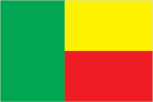
Flag description
- two equal horizontal bands of yellow (top) and red (bottom) with a vertical green band on the hoist side; green symbolizes hope and revival, yellow wealth, and red courage
- note
- note: uses the popular Pan-African colors of Ethiopia
Government type
presidential republic
Independence
1 August 1960 (from France)
International law organization participation
has not submitted an ICJ jurisdiction declaration; accepts ICCt jurisdiction
International organization participation
ACP, AfDB, AU, CD, ECOWAS, Entente, FAO, FZ, G-77, IAEA, IBRD, ICAO, ICCt, ICRM, IDA, IDB, IFAD, IFC, IFRCS, ILO, IMF, IMO, Interpol, IOC, IOM, IPU, ISO, ITSO, ITU, ITUC (NGOs), MIGA, MINUSMA, MONUSCO, NAM, OAS (observer), OIC, OIF, OPCW, PCA, UN, UNAMID, UNCTAD, UNESCO, UNHCR, UNIDO, UNMIL, UNMISS, UNOCI, UNWTO, UPU, WADB (regional), WAEMU, WCO, WFTU (NGOs), WHO, WIPO, WMO, WTO
Judicial branch
- highest courts
- Supreme Court or Cour Supreme (consists of the chief justice and 16 justices organized into an administrative division, judicial chamber, and chamber of accounts); Constitutional Court or Cour Constitutionnelle (consists of 7 members, including the court president); High Court of Justice (consists of the Constitutional Court members, 6 members appointed by the National Assembly, and the Supreme Court president); note - jurisdiction of the High Court of Justice is limited to cases of high treason by the national president or members of the government while in office
- judge selection and term of office
- Supreme Court president and judges appointed by the president of the republic upon the advice of the National Assembly; judges appointed for single renewable 5-year terms; Constitutional Court members - 4 appointed by the National Assembly and 3 by the president of the republic; members appointed for single renewable 5-year terms; other members of the High Court of Justice elected by the National Assembly; member tenure NA
- subordinate courts
- Court of Appeal or Cour d'Appel; district courts; village courts; Assize courts
Legal system
civil law system modeled largely on the French system and some customary law
Legislative branch
- description
- unicameral National Assembly or Assemblee Nationale (83 seats; members directly elected in multi-seat constituencies by proportional representation vote; members serve 4-year terms)
- election results
- percent of vote by party - Union Progressiste 56.2%, Bloc Republicain 43.8%; seats by party - Union Progressiste 47, Bloc Republicain 36; composition - men 77, women 6, percent of women 7.2%
- elections
- last held on 28 April 2019 (next to be held in April 2023)
National anthem
- lyrics/music
- Gilbert Jean DAGNON
- name
- "L'Aube Nouvelle" (The Dawn of a New Day)
- note
- note: adopted 1960
National holiday
Independence Day, 1 August (1960)
National symbol(s)
leopard; national colors: green, yellow, red
Political parties and leaders
- Alliance for a Triumphant Benin or ABT [Abdoulaye BIO TCHANE]African Movement for Development and Progress or MADEP [Sefou FAGBOHOUN]Benin Renaissance or RB [Lehady SOGLO]Cowrie Force for an Emerging Benin or FCBE [Yayi BONI]Democratic Renewal Party or PRD [Adrien HOUNGBEDJI]National Alliance for Development and Democracy or AND [Valentin Aditi HOUDE]New Consciousness Rally or NC [Pascal KOUPAKI]Patriotic Awakening or RP [Janvier YAHOUEDEOU]Social Democrat Party or PSD [Emmanuel GOLOU]Sun Alliance or AS [Sacca LAFIA]Union Makes the Nation or UN [Adrien HOUNGBEDJI] (includes PRD, MADEP)United Democratic Forces or FDU [Mathurin NAGO]
- note
- note: approximately 20 additional minor parties
Suffrage
18 years of age; universal
Economy
Agricultural products
cassava, yams, maize, cotton, oil palm fruit, rice, pineapples, tomatoes, vegetables, soybeans
Budget
- expenditures
- 2.152 billion (2017 est.)
- revenues
- 1.578 billion (2017 est.)
Budget surplus (+) or deficit (-)
-6.2% (of GDP) (2017 est.)
Credit ratings
- Fitch rating
- B (2019)
- Moody's rating
- B2 (2019)
- Standard & Poors rating
- B+ (2018)
Current account balance
- Current account balance 2016
- -$808 million (2016 est.)
- Current account balance 2017
- -$1.024 billion (2017 est.)
Debt - external
- Debt - external 31 December 2016
- $2.476 billion (31 December 2016 est.)
- Debt - external 31 December 2017
- $2.804 billion (31 December 2017 est.)
Economic overview
The free market economy of Benin has grown consecutively for four years, though growth slowed in 2017, as its close trade links to Nigeria expose Benin to risks from volatile commodity prices. Cotton is a key export commodity, with export earnings significantly impacted by the price of cotton in the broader market. The economy began deflating in 2017, with the consumer price index falling 0.8%.During the first two years of President TALON’s administration, which began in April 2016, the government has followed an ambitious action plan to kickstart development through investments in infrastructure, education, agriculture, and governance. Electricity generation, which has constrained Benin’s economic growth, has increased and blackouts have been considerably reduced. Private foreign direct investment is small, and foreign aid accounts for a large proportion of investment in infrastructure projects.Benin has appealed for international assistance to mitigate piracy against commercial shipping in its territory, and has used equipment from donors effectively against such piracy. Pilferage has significantly dropped at the Port of Cotonou, though the port is still struggling with effective implementation of the International Ship and Port Facility Security (ISPS) Code. Projects included in Benin's $307 million Millennium Challenge Corporation (MCC) first compact (2006-11) were designed to increase investment and private sector activity by improving key institutional and physical infrastructure. The four projects focused on access to land, access to financial services, access to justice, and access to markets (including modernization of the port). The Port of Cotonou is a major contributor to Benin’s economy, with revenues projected to account for more than 40% of Benin’s national budget.Benin will need further efforts to upgrade infrastructure, stem corruption, and expand access to foreign markets to achieve its potential. In September 2015, Benin signed a second MCC Compact for $375 million that entered into force in June 2017 and is designed to strengthen the national utility service provider, attract private sector investment, fund infrastructure investments in electricity generation and distribution, and develop off-grid electrification for poor and unserved households. As part of the Government of Benin’s action plan to spur growth, Benin passed public private partnership legislation in 2017 to attract more foreign investment, place more emphasis on tourism, facilitate the development of new food processing systems and agricultural products, encourage new information and communication technology, and establish Independent Power Producers. In April 2017, the IMF approved a three year $150.4 million Extended Credit Facility agreement to maintain debt sustainability and boost donor confidence.
Exchange rates
- currency
- Communaute Financiere Africaine francs (XOF) per US dollar -
- Exchange rates 2013
- 494.42 (2013 est.)
- Exchange rates 2014
- 591.45 (2014 est.)
- Exchange rates 2015
- 593.01 (2015 est.)
- Exchange rates 2016
- 593.01 (2016 est.)
- Exchange rates 2017
- 605.3 (2017 est.)
Exports
- Exports 2018
- $3.85 billion note: data are in current year dollars (2018 est.)
- Exports 2019
- $3.58 billion note: data are in current year dollars (2019 est.)
Exports - commodities
cotton, refined petroleum, gold, cashews, copper (2019)
Exports - partners
Nigeria 25%, Bangladesh 14%, United Arab Emirates 14%, India 13%, China 8%, Vietnam 5% (2019)
Fiscal year
calendar year
GDP - composition, by end use
- exports of goods and services
- 31.6% (2017 est.)
- government consumption
- 13.1% (2017 est.)
- household consumption
- 70.5% (2017 est.)
- imports of goods and services
- -43% (2017 est.)
- investment in fixed capital
- 27.6% (2017 est.)
- investment in inventories
- 0% (2017 est.)
GDP - composition, by sector of origin
- agriculture
- 26.1% (2017 est.)
- industry
- 22.8% (2017 est.)
- services
- 51.1% (2017 est.)
GDP (official exchange rate)
$10.315 billion (2018 est.)
Gini Index coefficient - distribution of family income
- Gini Index coefficient - distribution of family income 2015
- 47.8 (2015 est.)
Household income or consumption by percentage share
- highest 10%
- 29% (2003)
- lowest 10%
- 3.1%
Imports
- Imports 2017
- $5.035 billion (2017 est.)
- Imports 2018
- $4.67 billion note: data are in current year dollars (2018 est.)
- Imports 2019
- $4.31 billion note: data are in current year dollars (2019 est.)
Imports - commodities
rice, cars, palm oil, electricity, cotton (2019)
Imports - partners
China 28%, Thailand 9%, India 8%, Togo 6%, United States 5% (2019)
Industrial production growth rate
3% (2017 est.)
Industries
textiles, food processing, construction materials, cement
Inflation rate (consumer prices)
- Inflation rate (consumer prices) 2017
- 0% (2017 est.)
- Inflation rate (consumer prices) 2018
- 1.7% (2018 est.)
- Inflation rate (consumer prices) 2019
- -0.8% (2019 est.)
Labor force
3.662 million (2007 est.)
Population below poverty line
38.5% (2019 est.)
Public debt
- Public debt 2016
- 49.7% of GDP (2016 est.)
- Public debt 2017
- 54.6% of GDP (2017 est.)
Real GDP (purchasing power parity)
- note
- note: data are in 2017 dollars
- Real GDP (purchasing power parity) 2018
- $36.3 billion note: data are in 2017 dollars (2018 est.)
- Real GDP (purchasing power parity) 2019
- $38.79 billion note: data are in 2017 dollars (2019 est.)
- Real GDP (purchasing power parity) 2020
- $40.29 billion note: data are in 2017 dollars (2020 est.)
Real GDP growth rate
- Real GDP growth rate 2015
- 2.1% (2015 est.)
- Real GDP growth rate 2016
- 4% (2016 est.)
- Real GDP growth rate 2017
- 5.6% (2017 est.)
Real GDP per capita
- note
- note: data are in 2017 dollars
- Real GDP per capita 2018
- $3,200 note: data are in 2017 dollars (2018 est.)
- Real GDP per capita 2019
- $3,300 note: data are in 2017 dollars (2019 est.)
- Real GDP per capita 2020
- $3,300 note: data are in 2017 dollars (2020 est.)
Reserves of foreign exchange and gold
- Reserves of foreign exchange and gold 31 December 2016
- $57.5 million (31 December 2016 est.)
- Reserves of foreign exchange and gold 31 December 2017
- $698.9 million (31 December 2017 est.)
Taxes and other revenues
17.1% (of GDP) (2017 est.)
Unemployment rate
- Unemployment rate 2014
- 1% (2014 est.)
Unemployment, youth ages 15-24
- female
- 4.5% (2018 est.)
- male
- 3.2%
- total
- 3.9%
Energy
Crude oil - exports
0 bbl/day (2015 est.)
Crude oil - imports
0 bbl/day (2015 est.)
Crude oil - production
0 bbl/day (2018 est.)
Crude oil - proved reserves
8 million bbl (1 January 2018 est.)
Electricity - consumption
1.143 billion kWh (2016 est.)
Electricity - exports
0 kWh (2016 est.)
Electricity - from fossil fuels
88% of total installed capacity (2016 est.)
Electricity - from hydroelectric plants
9% of total installed capacity (2017 est.)
Electricity - from nuclear fuels
0% of total installed capacity (2017 est.)
Electricity - from other renewable sources
2% of total installed capacity (2017 est.)
Electricity - imports
1.088 billion kWh (2016 est.)
Electricity - installed generating capacity
321,000 kW (2016 est.)
Electricity - production
335 million kWh (2016 est.)
Electricity access
- electrification - rural areas
- 9% (2019)
- electrification - total population
- 33% (2019)
- electrification - urban areas
- 58% (2019)
Natural gas - consumption
0 cu m (2017 est.)
Natural gas - exports
0 cu m (2017 est.)
Natural gas - imports
0 cu m (2017 est.)
Natural gas - production
0 cu m (2017 est.)
Natural gas - proved reserves
1.133 billion cu m (1 January 2018 est.)
Refined petroleum products - consumption
38,000 bbl/day (2016 est.)
Refined petroleum products - exports
1,514 bbl/day (2015 est.)
Refined petroleum products - imports
38,040 bbl/day (2015 est.)
Refined petroleum products - production
0 bbl/day (2015 est.)
Communications
Broadband - fixed subscriptions
- subscriptions per 100 inhabitants
- less than 1 (2020 est.)
- total
- 29,981 (2020)
Broadcast media
state-run Office de Radiodiffusion et de Television du Benin (ORTB) operates a TV station providing a wide broadcast reach; several privately owned TV stations broadcast from Cotonou; satellite TV subscription service is available; state-owned radio, under ORTB control, includes a national station supplemented by a number of regional stations; substantial number of privately owned radio broadcast stations; transmissions of a few international broadcasters are available on FM in Cotonou (2019)
Internet country code
.bj
Internet users
- percent of population
- 28.4% (2019 est.)
- total
- 3.5 million (2021 est.)
Telecommunication systems
- domestic
- fixed-line teledensity only about 1 per 100 persons; spurred by the presence of multiple mobile-cellular providers, cellular telephone subscribership has increased rapidly, exceeding 91 per 100 persons (2020)
- general assessment
- Benin’s telecom market is restricted by poor fixed-line infrastructure; low use of fixed-line voice and Internet; mobile networks account for almost all Internet and voice traffic; progress on fiber infrastructure through World Bank and the government investment to extend broadband and develop Smart Government program; monopolized fixed-line Internet services access is limited; ICT development will provide telecom services to 80% of the country, mostly via mobile and DSL infrastructure; Benin Smart City construction has begun; improved international Internet connectivity supports growth of m-commerce and m-banking; submarine cable connectivity from African coast to Europe (2020)
- international
- country code - 229; landing points for the SAT-3/WASC and ACE fiber-optic submarine cable that provides connectivity to Europe, and most West African countries; satellite earth stations - 7 (Intelsat-Atlantic Ocean) (2019)
- note
- note: the COVID-19 pandemic continues to have a significant impact on production and supply chains globally; since 2020, some aspects of the telecom sector have experienced downturn, particularly in mobile device production; many network operators delayed upgrades to infrastructure; progress towards 5G implementation was postponed or slowed in some countries; consumer spending on telecom services and devices was affected by large-scale job losses and the consequent restriction on disposable incomes; the crucial nature of telecom services as a tool for work and school from home became evident, and received some support from governments
Telephones - fixed lines
- subscriptions per 100 inhabitants
- less than 1 (2020 est.)
- total subscriptions
- 32,386 (2020)
Telephones - mobile cellular
- subscriptions per 100 inhabitants
- 91.9 (2020 est.)
- total subscriptions
- 11,140,891 (2020)
Transportation
Airports
- total
- 6 (2013)
Airports - with paved runways
- 1,524 to 2,437 m
- 1 (2017)
- total
- 1
Airports - with unpaved runways
- 1,524 to 2,437 m
- 1
- 2,438 to 3,047 m
- 2
- 914 to 1,523 m
- 2 (2013)
- total
- 5
Civil aircraft registration country code prefix
TY
Merchant marine
- by type
- other 6 (2021)
- total
- 6
National air transport system
- annual freight traffic on registered air carriers
- 805,347 mt-km (2015)
- annual passenger traffic on registered air carriers
- 112,392 (2015)
- inventory of registered aircraft operated by air carriers
- 1 (2015)
- number of registered air carriers
- 1 (2015)
Pipelines
134 km gas
Ports and terminals
- LNG terminal(s) (import)
- Cotonou
- major seaport(s)
- Cotonou
Railways
- narrow gauge
- 438 km 1.000-m gauge (2014)
- total
- 438 km (2014)
Roadways
- paved
- 1,400 km (2006)
- total
- 16,000 km (2006)
- unpaved
- 14,600 km (2006)
Waterways
150 km (seasonal navigation on River Niger along northern border) (2011)
Military and Security
Maritime threats
the International Maritime Bureau reports the territorial and offshore waters in the Niger Delta and Gulf of Guinea remain a very high risk for piracy and armed robbery of ships; in 2020, there were 98 reported incidents of piracy and armed robbery at sea in the Gulf of Guinea region; although a 24% decrease from the total number of incidents in 2019, it included all three hijackings and 9 of 11 ships fired upon worldwide; while boarding and attempted boarding to steal valuables from ships and crews are the most common types of incidents, almost a third of all incidents involve a hijacking and/or kidnapping; in 2020, a record 130 crew members were kidnapped in 22 separate incidents in the Gulf of Guinea, representing 95% of kidnappings worldwide; approximately 51% of all incidents of piracy and armed robbery are taking place off Nigeria, which is a decrease from the 71% in 2019 and an indication pirates are traveling further to target vessels; Nigerian pirates are well armed and very aggressive, operating as far as 200 nm offshore; the Maritime Administration of the US Department of Transportation has issued a Maritime Advisory (2021-002 - Gulf of Guinea-Piracy/Armed Robbery/Kidnapping for Ransom) effective 9 January 2021, which states in part, "Piracy, armed robbery, and kidnapping for ransom continue to serve as significant threats to US-flagged vessels transiting or operating in the Gulf of Guinea.”
Military - note
as of 2021, Benin participated in the Multinational Joint Task Force (MNJTF) against Boko Haram along with Cameroon, Chad, Niger, and Nigeria; the Benin military contingent is in charge of MNJTF garrison duties the FAB has a close working relationship with the Belgian armed forces; the Belgians offer advice, training, and secondhand equipment donations, and deploy to Benin for limited military exercises
Military and security forces
Benin Armed Forces (Forces Armees Beninoises, FAB): Army, Navy, Air Force; Ministry of Interior and Public Security: Republican Police (Police Republicaine, DGPR) (2021)
Military and security service personnel strengths
the Benin Armed Forces (FAB) are comprised of approximately 7,000 active duty troops; est. 5,000 Republican Police (2021)
Military deployments
250 Mali (MINUSMA) (Jan 2021)
Military equipment inventories and acquisitions
the FAB is equipped with a small mix of mostly older French and Soviet-era equipment (2021)
Military expenditures
- Military Expenditures 2016
- 1.1% of GDP (2016)
- Military Expenditures 2017
- 1.3% of GDP (2017)
- Military Expenditures 2018
- 0.9% of GDP (2018)
- Military Expenditures 2019
- 0.7% of GDP (2019)
- Military Expenditures 2020
- 0.5% of GDP (2020 est.)
Military service age and obligation
18-35 years of age for selective compulsory and voluntary military service; a higher education diploma is required; both sexes are eligible for military service; conscript tour of duty - 18 months (2019)
Transnational Issues
Disputes - international
talks continue between Benin and Togo on funding the Adjrala hydroelectric dam on the Mona River; Benin retains a border dispute with Burkina Faso near the town of Koualou; location of Benin-Niger-Nigeria tripoint is unresolved
Illicit drugs
a significant transit and departure country for cocaine shipments in Africa destined for Europe
Terrorism
Terrorist group(s)
- al-Qa’ida (Jama’at Nusrat al Islam wal Muslimeen); Islamic State in the Greater Sahara (2020)
- note
- note: details about the history, aims, leadership, organization, areas of operation, tactics, targets, weapons, size, and sources of support of the group(s) appear(s) in Appendix-T
Environment
Air pollutants
- carbon dioxide emissions
- 6.48 megatons (2016 est.)
- methane emissions
- 5.8 megatons (2020 est.)
- particulate matter emissions
- 33.11 micrograms per cubic meter (2016 est.)
Climate
tropical; hot, humid in south; semiarid in north
Environment - current issues
inadequate supplies of potable water; water pollution; poaching threatens wildlife populations; deforestation; desertification (the spread of the desert into agricultural lands in the north is accelerated by regular droughts)
Environment - international agreements
- party to
- Biodiversity, Climate Change, Climate Change-Kyoto Protocol, Climate Change-Paris Agreement, Comprehensive Nuclear Test Ban, Desertification, Endangered Species, Environmental Modification, Hazardous Wastes, Law of the Sea, Marine Dumping-London Convention, Nuclear Test Ban, Ozone Layer Protection, Ship Pollution, Tropical Timber 2006, Wetlands, Whaling
- signed, but not ratified
- none of the selected agreements
Land use
- agricultural land
- 31.3% (2018 est.)
- agricultural land: arable land
- arable land: 22.9% (2018 est.)
- agricultural land: permanent crops
- permanent crops: 3.5% (2018 est.)
- agricultural land: permanent pasture
- permanent pasture: 4.9% (2018 est.)
- forest
- 40% (2018 est.)
- other
- 28.7% (2018 est.)
Major infectious diseases
- animal contact diseases
- rabies
- degree of risk
- very high (2020)
- food or waterborne diseases
- bacterial and protozoal diarrhea, hepatitis A, and typhoid fever
- respiratory diseases
- meningococcal meningitis
- vectorborne diseases
- dengue fever and malaria
Major watersheds (area sq km)
Atlantic Ocean drainage: Niger (2,261,741 sq km), Volta (410,991 sq km)
Revenue from coal
- coal revenues
- 0% of GDP (2018 est.)
Revenue from forest resources
- forest revenues
- 2.24% of GDP (2018 est.)
Total renewable water resources
26.39 billion cubic meters (2017 est.)
Total water withdrawal
- agricultural
- 59 million cubic meters (2017 est.)
- industrial
- 30 million cubic meters (2017 est.)
- municipal
- 145 million cubic meters (2017 est.)
Urbanization
- rate of urbanization
- 3.74% annual rate of change (2020-25 est.)
- urban population
- 49% of total population (2021)
Waste and recycling
- municipal solid waste generated annually
- 685,936 tons (1993 est.)
- municipal solid waste recycled annually
- 171,484 tons (2005 est.)
- percent of municipal solid waste recycled
- 25% (2005 est.)