2014 Edition
CIA World Factbook 2014 Archive (HTML)
Introduction
Background
Present day Benin was the site of Dahomey, a West African kingdom that rose to prominence in about 1600 and over the next two and half centuries became a regional power, largely based on its slave trade. Coastal areas of Dahomey began to be controlled by the French in the second half of the 19th century; the entire kingdom was conquered by 1894. French Dahomey achieved independence in 1960; it changed its name to the Republic of Benin in 1975. A succession of military governments ended in 1972 with the rise to power of Mathieu KEREKOU and the establishment of a government based on Marxist-Leninist principles. A move to representative government began in 1989. Two years later, free elections ushered in former Prime Minister Nicephore SOGLO as president, marking the first successful transfer of power in Africa from a dictatorship to a democracy. KEREKOU was returned to power by elections held in 1996 and 2001, though some irregularities were alleged. KEREKOU stepped down at the end of his second term in 2006 and was succeeded by Thomas YAYI Boni, a political outsider and independent. YAYI, who won a second five-year term in March 2011, has attempted to stem corruption and has strongly promoted accelerating Benin's economic growth.
Geography
Area
- 112,622 sq km 110,622 sq km 2,000 sq km
- total
- 112,622 sq km
- water
- 2,000 sq km
Area - comparative
slightly smaller than Pennsylvania
Climate
tropical; hot, humid in south; semiarid in north
Coastline
121 km
Elevation extremes
- Atlantic Ocean 0 m Mont Sokbaro 658 m
- highest point
- Mont Sokbaro 658 m
- lowest point
- Atlantic Ocean 0 m
Environment - current issues
inadequate supplies of potable water; poaching threatens wildlife populations; deforestation; desertification
Environment - international agreements
- Biodiversity, Climate Change, Climate Change-Kyoto Protocol, Desertification, Endangered Species, Environmental Modification, Hazardous Wastes, Law of the Sea, Ozone Layer Protection, Ship Pollution, Wetlands, Whaling none of the selected agreements
- party to
- Biodiversity, Climate Change, Climate Change-Kyoto Protocol, Desertification, Endangered Species, Environmental Modification, Hazardous Wastes, Law of the Sea, Ozone Layer Protection, Ship Pollution, Wetlands, Whaling
- signed, but not ratified
- none of the selected agreements
Freshwater withdrawal (domestic/industrial/agricultural)
- 0.13 cu km/yr (32%/23%/45%) 18.74 cu m/yr (2001)
- per capita
- 18.74 cu m/yr (2001)
- total
- 0.13 cu km/yr (32%/23%/45%)
Geographic coordinates
9 30 N, 2 15 E
Geography - note
sandbanks create difficult access to a coast with no natural harbors, river mouths, or islands
Irrigated land
230.4 sq km (2008)
Land boundaries
- 2,123 km Burkina Faso 386 km, Niger 277 km, Nigeria 809 km, Togo 651 km
- border countries
- Burkina Faso 386 km, Niger 277 km, Nigeria 809 km, Togo 651 km
- total
- 2,123 km
Land use
- 22.48% 2.61% 74.9% (2011)
- arable land
- 22.48%
- other
- 74.9% (2011)
- permanent crops
- 2.61%
Location
Western Africa, bordering the Bight of Benin, between Nigeria and Togo
Map references
Africa
Maritime claims
- 200 nm
- territorial sea
- 200 nm
Natural hazards
hot, dry, dusty harmattan wind may affect north from December to March
Natural resources
small offshore oil deposits, limestone, marble, timber
Terrain
mostly flat to undulating plain; some hills and low mountains
Total renewable water resources
26.39 cu km (2011)
People and Society
Age structure
- 43.8% (male 2,269,896/female 2,179,026) 20.1% (male 1,036,963/female 1,001,400) 29.9% (male 1,530,283/female 1,504,201) 3.5% (male 149,883/female 205,701) 2.8% (male 112,830/female 170,373) (2014 est.)
- 0-14 years
- 43.8% (male 2,269,896/female 2,179,026)
- 15-24 years
- 20.1% (male 1,036,963/female 1,001,400)
- 25-54 years
- 29.9% (male 1,530,283/female 1,504,201)
- 55-64 years
- 3.5% (male 149,883/female 205,701)
- 65 years and over
- 2.8% (male 112,830/female 170,373) (2014 est.)
Birth rate
36.51 births/1,000 population (2014 est.)
Child labor - children ages 5-14
- 1,020,981 46 % (2006 est.)
- percentage
- 46 % (2006 est.)
- total number
- 1,020,981
Children under the age of 5 years underweight
20.2% (2006)
Contraceptive prevalence rate
12.9% (2012)
Death rate
8.39 deaths/1,000 population (2014 est.)
Dependency ratios
- 83 % 77.7 % 5.3 % 18.9 (2014 est.)
- elderly dependency ratio
- 5.3 %
- potential support ratio
- 18.9 (2014 est.)
- total dependency ratio
- 83 %
- youth dependency ratio
- 77.7 %
Drinking water source
- urban: 84.5% of population rural: 69.1% of population total: 76.1% of population urban: 15.5% of population rural: 30.9% of population total: 23.9% of population (2012 est.)
- rural
- 30.9% of population
- total
- 23.9% of population (2012 est.)
- urban
- 15.5% of population
Education expenditures
5.3% of GDP (2010)
Ethnic groups
Fon and related 39.2%, Adja and related 15.2%, Yoruba and related 12.3%, Bariba and related 9.2%, Peulh and related 7%, Ottamari and related 6.1%, Yoa-Lokpa and related 4%, Dendi and related 2.5%, other 1.6% (includes Europeans), unspecified 2.9% (2002 census)
Health expenditures
4.6% of GDP (2011)
HIV/AIDS - adult prevalence rate
1.1% (2012 est.)
HIV/AIDS - deaths
3,100 (2012 est.)
HIV/AIDS - people living with HIV/AIDS
71,500 (2012 est.)
Hospital bed density
0.5 beds/1,000 population (2010)
Infant mortality rate
- 57.09 deaths/1,000 live births 60.26 deaths/1,000 live births 53.76 deaths/1,000 live births (2014 est.)
- female
- 53.76 deaths/1,000 live births (2014 est.)
- total
- 57.09 deaths/1,000 live births
Languages
French (official), Fon and Yoruba (most common vernaculars in south), tribal languages (at least six major ones in north)
Life expectancy at birth
- 61.07 years 59.75 years 62.47 years (2014 est.)
- female
- 62.47 years (2014 est.)
- total population
- 61.07 years
Literacy
- age 15 and over can read and write 42.4% 55.2% 30.3% (2010 census)
- definition
- age 15 and over can read and write
- female
- 30.3% (2010 census)
- male
- 55.2%
- total population
- 42.4%
Major infectious diseases
- very high bacterial and protozoal diarrhea, hepatitis A, and typhoid fever dengue fever, malaria, and yellow fever meningococcal meningitis rabies (2013)
- animal contact disease
- rabies (2013)
- degree of risk
- very high
- food or waterborne diseases
- bacterial and protozoal diarrhea, hepatitis A, and typhoid fever
- respiratory disease
- meningococcal meningitis
- vectorborne diseases
- dengue fever, malaria, and yellow fever
Major urban areas - population
COTONOU (seat of government) 924,000; PORTO-NOVO (capital) 314,000 (2011)
Maternal mortality rate
350 deaths/100,000 live births (2010)
Median age
- 17.7 years 17.4 years 18.1 years (2014 est.)
- female
- 18.1 years (2014 est.)
- male
- 17.4 years
- total
- 17.7 years
Mother's mean age at first birth
20.3 median age at first birth among women 25-29 (2011-12 est.)
Nationality
- Beninese (singular and plural) Beninese
- adjective
- Beninese
- noun
- Beninese (singular and plural)
Net migration rate
0 migrant(s)/1,000 population (2014 est.)
Obesity - adult prevalence rate
6% (2008)
Physicians density
0.06 physicians/1,000 population (2008)
Population
10,160,556 estimates for this country explicitly take into account the effects of excess mortality due to AIDS; this can result in lower life expectancy, higher infant mortality, higher death rates, lower population growth rates, and changes in the distribution of population by age and sex than would otherwise be expected (July 2014 est.)
Population growth rate
2.81% (2014 est.)
Religions
Catholic 27.1%, Muslim 24.4%, Vodoun 17.3%, Protestant 10.4% (Celestial 5%, Methodist 3.2%, other Protestant 2.2%), other Christian 5.3%, other 15.5% (2002 census)
Sanitation facility access
- urban: 25.3% of population rural: 5.1% of population total: 14.3% of population urban: 74.7% of population rural: 94.9% of population total: 85.7% of population (2012 est.)
- rural
- 94.9% of population
- total
- 85.7% of population (2012 est.)
- urban
- 74.7% of population
School life expectancy (primary to tertiary education)
- 11 years 13 years 9 years (2011)
- female
- 9 years (2011)
- male
- 13 years
- total
- 11 years
Sex ratio
- 1.05 male(s)/female 1.04 male(s)/female 1.04 male(s)/female 1.02 male(s)/female 1.01 male(s)/female 0.67 male(s)/female 1.01 male(s)/female (2014 est.)
- 0-14 years
- 1.04 male(s)/female
- 15-24 years
- 1.04 male(s)/female
- 25-54 years
- 1.02 male(s)/female
- 55-64 years
- 1.01 male(s)/female
- 65 years and over
- 0.67 male(s)/female
- at birth
- 1.05 male(s)/female
- total population
- 1.01 male(s)/female (2014 est.)
Total fertility rate
5.04 children born/woman (2014 est.)
Unemployment, youth ages 15-24
- 0.8% 1.1% 0.6% (2002)
- female
- 0.6% (2002)
- total
- 0.8%
Urbanization
- 44.9% of total population (2011) 4.12% annual rate of change (2010-15 est.)
- rate of urbanization
- 4.12% annual rate of change (2010-15 est.)
- urban population
- 44.9% of total population (2011)
Government
Administrative divisions
12 departments; Alibori, Atakora, Atlantique, Borgou, Collines, Kouffo, Donga, Littoral, Mono, Oueme, Plateau, Zou
Capital
- Porto-Novo (official capital); Cotonou (seat of government) 6 29 N, 2 37 E UTC+1 (6 hours ahead of Washington, DC, during Standard Time)
- geographic coordinates
- 6 29 N, 2 37 E
- name
- Porto-Novo (official capital); Cotonou (seat of government)
- time difference
- UTC+1 (6 hours ahead of Washington, DC, during Standard Time)
Constitution
previous 1946, 1958 (preindependence); latest adopted by referendum 2 December 1990, promulgated 11 December 1990 (2012)
Country name
- Republic of Benin Benin Republique du Benin Benin Dahomey
- conventional long form
- Republic of Benin
- conventional short form
- Benin
- former
- Dahomey
- local long form
- Republique du Benin
- local short form
- Benin
Diplomatic representation from the US
- Ambassador Michael RAYNOR (since 24 May 2012) Rue Caporal Bernard Anani, Cotonou 01 B. P. 2012, Cotonou [229] 21-30-06-50 [229] 21-30-66-82
- chief of mission
- Ambassador Michael RAYNOR (since 24 May 2012)
- embassy
- Rue Caporal Bernard Anani, Cotonou
- FAX
- [229] 21-30-66-82
- mailing address
- 01 B. P. 2012, Cotonou
- telephone
- [229] 21-30-06-50
Diplomatic representation in the US
- Ambassador Omar AROUNA (since 21 May 2014) 2124 Kalorama Road NW, Washington, DC 20008 [1] (202) 232-6656 [1] (202) 265-1996
- chancery
- 2124 Kalorama Road NW, Washington, DC 20008
- chief of mission
- Ambassador Omar AROUNA (since 21 May 2014)
- FAX
- [1] (202) 265-1996
- telephone
- [1] (202) 232-6656
Executive branch
- President Thomas YAYI Boni (since 6 April 2006); note - the president is both chief of state and head of government President Thomas YAYI Boni (since 6 April 2006); Prime Minister Pascal KOUPAKI (since 28 May 2011) Council of Ministers appointed by the president president elected by popular vote for a five-year term (eligible for a second term); last held on 13 March 2011 (next to be held in March 2016) Thomas YAYI Boni re-elected president; percent of vote - Thomas YAYI Boni 53.1%, Adrien HOUNGBEDJI 35.6%, Abdoulaye Bio TCHANE 6.1%, other 5.2%
- cabinet
- Council of Ministers appointed by the president
- chief of state
- President Thomas YAYI Boni (since 6 April 2006); note - the president is both chief of state and head of government
- election results
- Thomas YAYI Boni re-elected president; percent of vote - Thomas YAYI Boni 53.1%, Adrien HOUNGBEDJI 35.6%, Abdoulaye Bio TCHANE 6.1%, other 5.2%
- elections
- president elected by popular vote for a five-year term (eligible for a second term); last held on 13 March 2011 (next to be held in March 2016)
- head of government
- President Thomas YAYI Boni (since 6 April 2006); Prime Minister Pascal KOUPAKI (since 28 May 2011)
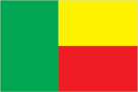
Flag description
two equal horizontal bands of yellow (top) and red (bottom) with a vertical green band on the hoist side; green symbolizes hope and revival, yellow wealth, and red courage uses the popular Pan-African colors of Ethiopia
Government type
republic
Independence
1 August 1960 (from France)
International law organization participation
has not submitted an ICJ jurisdiction declaration; accepts ICCt jurisdiction
International organization participation
ACP, AfDB, AU, CD, ECOWAS, Entente, FAO, FZ, G-77, IAEA, IBRD, ICAO, ICRM, IDA, IDB, IFAD, IFC, IFRCS, ILO, IMF, IMO, Interpol, IOC, IOM, IPU, ISO (correspondent), ITSO, ITU, ITUC (NGOs), MIGA, MINUSMA, MONUSCO, NAM, OAS (observer), OIC, OIF, OPCW, PCA, UN, UNCTAD, UNESCO, UNHCR, UNIDO, UNISFA, UNMIL, UNMISS, UNOCI, UNWTO, UPU, WAEMU, WCO, WFTU (NGOs), WHO, WIPO, WMO, WTO
Judicial branch
- Supreme Court or Cour Supreme (consists of the court president and 3 chamber presidents organized into an administrative division, judicial chamber, and chamber of accounts) Constitutional Court or Cour Constitutionnelle (consists of 7 members including the court president); High Court of Justice (consists of the Constitutional Court members, 6 members appointed by the National Assembly, and the Supreme Court president) note - jurisdiction of the High Court of Justice is to limited cases of high treason by the national president or members of the government Supreme Court president and judges appointed by the national president upon the advice of the National Assembly; judges appointed for single renewable 5-year terms; Constitutional Court members - 4 appointed by the National Assembly and 3 by the national president; members appointed for single renewable 5-year terms; High Court of Justice "other" members elected by the National Assembly; member tenure NA Court of Appeal or Cour d'Appel; district courts; village courts; Assize courts
- highest court(s)
- Supreme Court or Cour Supreme (consists of the court president and 3 chamber presidents organized into an administrative division, judicial chamber, and chamber of accounts) Constitutional Court or Cour Constitutionnelle (consists of 7 members including the court president); High Court of Justice (consists of the Constitutional Court members, 6 members appointed by the National Assembly, and the Supreme Court president)
- judge selection and term of office
- Supreme Court president and judges appointed by the national president upon the advice of the National Assembly; judges appointed for single renewable 5-year terms; Constitutional Court members - 4 appointed by the National Assembly and 3 by the national president; members appointed for single renewable 5-year terms; High Court of Justice "other" members elected by the National Assembly; member tenure NA
- subordinate courts
- Court of Appeal or Cour d'Appel; district courts; village courts; Assize courts
Legal system
civil law system modeled largely on the French system and some customary law
Legislative branch
- unicameral National Assembly or Assemblee Nationale (83 seats; members are elected by direct popular vote to serve four-year terms) last held on 30 April 2011 (next to be held in 2015) percent of vote by party - NA; seats by party - FCBE 41, UN 30, other 12
- election results
- percent of vote by party - NA; seats by party - FCBE 41, UN 30, other 12
- elections
- last held on 30 April 2011 (next to be held in 2015)
National anthem
- "L'Aube Nouvelle" (The Dawn of a New Day) Gilbert Jean DAGNON adopted 1960
- lyrics/music
- Gilbert Jean DAGNON
- name
- "L'Aube Nouvelle" (The Dawn of a New Day)
National holiday
National Day, 1 August (1960)
National symbol(s)
leopard
Political parties and leaders
Be African Movement for Democracy and Progress or MADEP [Sefou FAGBOHOUN]; Alliance of Progress Forces or AFP; Benin Renaissance or RB [Rosine SOGLO]; Democratic Renewal Party or PRD [Adrien HOUNGBEDJI]; Force Cowrie for an Emerging Benin or FCBE [Yayi BONI]; Impulse for Progress and Democracy or IPD [Theophile NATA]; Key Force or FC [Lazare SÈHOUÉTO]; Movement for the People's Alternative or MAP [Olivier CAPO-CHICHI]; Rally for Democracy and Progress or RDP [Dominique HOUNGNINOU]; Social Democrat Party or PSD [Emmanuel GOLOU]; Union for Democracy and National Solidarity or UDS [Sacca LAFIA]; Union for the Relief or UPR [Issa SALIFOU]; Union Makes the Nation or UN [Adrien HOUNGBEDJI] (superceded Alliance for Dynamic Democracy or ADD) approximately 20 additional minor parties
Political pressure groups and leaders
- economic groups; environmentalists; political groups; teachers' unions and other educational groups
- other
- economic groups; environmentalists; political groups; teachers' unions and other educational groups
Suffrage
18 years of age; universal
Economy
Agriculture - products
cotton, corn, cassava (manioc, tapioca), yams, beans, palm oil, peanuts, cashews; livestock
Budget
- $1.712 billion $1.825 billion (2013 est.)
- expenditures
- $1.825 billion (2013 est.)
- revenues
- $1.712 billion
Budget surplus (+) or deficit (-)
-1.3% of GDP (2013 est.)
Central bank discount rate
4.25% (31 December 2010 est.) 4.25% (31 December 2009 est.)
Commercial bank prime lending rate
NA%
Current account balance
-$699.3 million (2013 est.) -$684.9 million (2012 est.)
Debt - external
$1.236 billion (31 December 2013 est.) $1.123 billion (31 December 2012 est.)
Distribution of family income - Gini index
36.5 (2003)
Economy - overview
The economy of Benin remains underdeveloped and dependent on subsistence agriculture, cotton production, and regional trade. Growth in real output had averaged almost 4% before the global recession and it has returned to roughly that level in 2011-12. Inflation has subsided over the past several years. In order to raise growth, Benin plans to attract more foreign investment, place more emphasis on tourism, facilitate the development of new food processing systems and agricultural products, and encourage new information and communication technology. Specific projects to improve the business climate by reforms to the land tenure system, the commercial justice system, and the financial sector were included in Benin's $307 million Millennium Challenge Account grant signed in February 2006. The 2001 privatization policy continues in telecommunications, water, electricity, and agriculture. The Paris Club and bilateral creditors have eased the external debt situation with Benin benefiting from a G-8 debt reduction announced in July 2005, while pressing for more rapid structural reforms. An insufficient electrical supply continues to adversely affect Benin's economic growth though the government recently has taken steps to increase domestic power production. Private foreign direct investment is small, and foreign aid accounts for the majority of investment in infrastructure projects. Cotton, a key export, suffered from flooding in 2010-11, but high prices supported export earnings. The government agreed to a 25% increase in civil servant salaries in 2011, following a series of strikes, increasing pressure on the national budget. Benin has appealed for international assistance to mitigate piracy against commercial shipping in its territory.
Exchange rates
Communaute Financiere Africaine francs (XOF) per US dollar - 500.7 (2013 est.) 510.53 (2012 est.) 495.28 (2010 est.) 472.19 (2009) 447.81 (2008)
Exports
$1.108 billion (2013 est.) $1.071 billion (2012 est.)
Exports - commodities
cotton, cashews, shea butter, textiles, palm products, seafood
Exports - partners
China 25%, India 23.5%, Lebanon 18.7%, Niger 4.3%, Nigeria 4% (2012)
Fiscal year
calendar year
GDP - composition, by end use
- NA cu m 12.7% 18.6% 0.2% 13.2% -26% (2013 est.)
- exports of goods and services
- 13.2%
- government consumption
- 12.7%
- household consumption
- NA cu m
- imports of goods and services
- -26%
- investment in fixed capital
- 18.6%
- investment in inventories
- 0.2%
GDP - composition, by sector of origin
- 31.6% 12.9% 55.6% (2013 est.)
- agriculture
- 31.6%
- industry
- 12.9%
- services
- 55.6% (2013 est.)
GDP - per capita (PPP)
$1,600 (2013 est.) $1,600 (2012 est.) $1,500 (2011 est.) data are in 2013 US dollars
GDP - real growth rate
5% (2013 est.) 5.4% (2012 est.) 3.5% (2011 est.)
GDP (official exchange rate)
$8.359 billion (2013 est.)
GDP (purchasing power parity)
$16.65 billion (2013 est.) $15.86 billion (2012 est.) $15.04 billion (2011 est.) data are in 2013 US dollars
Gross national saving
9.9% of GDP (2013 est.) 9% of GDP (2012 est.) 7.9% of GDP (2011 est.)
Household income or consumption by percentage share
- 3.1% 29% (2003)
- highest 10%
- 29% (2003)
- lowest 10%
- 3.1%
Imports
$1.835 billion (2013 est.) $1.755 billion (2012 est.)
Imports - commodities
foodstuffs, capital goods, petroleum products
Imports - partners
China 37.2%, US 8.9%, India 6.7%, France 5.6%, Malaysia 5.3% (2012)
Industrial production growth rate
3.7% (2013 est.)
Industries
textiles, food processing, construction materials, cement
Inflation rate (consumer prices)
2.4% (2013 est.) 6.8% (2012 est.)
Labor force
3.662 million (2007 est.)
Market value of publicly traded shares
$NA
Population below poverty line
37.4% (2007 est.)
Public debt
29.7% of GDP (2013 est.) 31.9% of GDP (2012 est.)
Reserves of foreign exchange and gold
$720.3 million (31 December 2013 est.) $712.8 million (31 December 2012 est.)
Stock of broad money
$3.06 billion (31 December 2013 est.) $2.943 billion (31 December 2012 est.)
Stock of domestic credit
$1.511 billion (31 December 2013 est.) $1.529 billion (31 December 2012 est.)
Stock of narrow money
$1.889 billion (31 December 2013 est.) $1.755 billion (31 December 2012 est.)
Taxes and other revenues
20.5% of GDP (2013 est.)
Unemployment rate
NA%
Energy
Carbon dioxide emissions from consumption of energy
4.655 million Mt (2011 est.)
Crude oil - exports
0 bbl/day (2010 est.)
Crude oil - imports
0 bbl/day (2010 est.)
Crude oil - production
0 bbl/day (2012 est.)
Crude oil - proved reserves
8 million bbl (1 January 2013 est.)
Electricity - consumption
870.1 million kWh (2010 est.)
Electricity - exports
0 kWh (2012 est.)
Electricity - from fossil fuels
98.4% of total installed capacity (2010 est.)
Electricity - from hydroelectric plants
1.6% of total installed capacity (2010 est.)
Electricity - from nuclear fuels
0% of total installed capacity (2010 est.)
Electricity - from other renewable sources
0% of total installed capacity (2010 est.)
Electricity - imports
935 million kWh (2010 est.)
Electricity - installed generating capacity
61,000 kW (2010 est.)
Electricity - production
142.1 million kWh (2010 est.)
Natural gas - consumption
0 cu m (2010 est.)
Natural gas - exports
0 cu m (2011 est.)
Natural gas - imports
0 cu m (2011 est.)
Natural gas - production
0 cu m (2011 est.)
Natural gas - proved reserves
1.133 billion cu m (1 January 2013 est.)
Refined petroleum products - consumption
29,170 bbl/day (2011 est.)
Refined petroleum products - exports
0 bbl/day (2010 est.)
Refined petroleum products - imports
34,840 bbl/day (2010 est.)
Refined petroleum products - production
0 bbl/day (2010 est.)
Communications
Broadcast media
state-run Office de Radiodiffusion et de Television du Benin (ORTB) operates a TV station with multiple channels giving it a wide broadcast reach; several privately owned TV stations broadcast from Cotonou; satellite TV subscription service is available; state-owned radio, under ORTB control, includes a national station supplemented by a number of regional stations; substantial number of privately owned radio broadcast stations; transmissions of a few international broadcasters are available on FM in Cotonou (2007)
Internet country code
.bj
Internet hosts
491 (2012)
Internet users
200,100 (2009)
Telephone system
- inadequate system of open-wire, microwave radio relay, and cellular connections; fixed-line network characterized by aging, deteriorating equipment fixed-line teledensity only about 2 per 100 persons; spurred by the presence of multiple mobile-cellular providers, cellular telephone subscribership has been increasing rapidly country code - 229; landing point for the SAT-3/WASC fiber-optic submarine cable that provides connectivity to Europe and Asia; long distance fiber-optic links with Togo, Burkina Faso, Niger, and Nigeria; satellite earth stations - 7 (Intelsat-Atlantic Ocean) (2008)
- domestic
- fixed-line teledensity only about 2 per 100 persons; spurred by the presence of multiple mobile-cellular providers, cellular telephone subscribership has been increasing rapidly
- general assessment
- inadequate system of open-wire, microwave radio relay, and cellular connections; fixed-line network characterized by aging, deteriorating equipment
- international
- country code - 229; landing point for the SAT-3/WASC fiber-optic submarine cable that provides connectivity to Europe and Asia; long distance fiber-optic links with Togo, Burkina Faso, Niger, and Nigeria; satellite earth stations - 7 (Intelsat-Atlantic Ocean) (2008)
Telephones - main lines in use
156,700 (2012)
Telephones - mobile cellular
8.408 million (2012)
Transportation
Airports
6 (2013)
Airports - with paved runways
- 1 (2013)
- 1,524 to 2,437 m
- 1 (2013)
- total
- 1
Airports - with unpaved runways
- 2 (2013)
- 1,524 to 2,437 m
- 1
- 2,438 to 3,047 m
- 2
- 914 to 1,523 m
- 2 (2013)
- total
- 5
Ports and terminals
- Cotonou
- major seaport(s)
- Cotonou
Railways
- 438 km 438 km 1.000-m gauge (2008)
- total
- 438 km
Roadways
- 16,000 km 1,400 km 14,600 km (2006)
- total
- 16,000 km
- unpaved
- 14,600 km (2006)
Waterways
150 km (seasonal navigation on River Niger along northern border) (2011)
Military and Security
Manpower available for military service
- 2,095,373 2,038,351 (2010 est.)
- females age 16-49
- 2,038,351 (2010 est.)
- males age 16-49
- 2,095,373
Manpower fit for military service
- 1,385,065 1,400,045 (2010 est.)
- females age 16-49
- 1,400,045 (2010 est.)
- males age 16-49
- 1,385,065
Manpower reaching militarily significant age annually
- 108,496 104,526 (2010 est.)
- female
- 104,526 (2010 est.)
- male
- 108,496
Military branches
- Benin Armed Forces (Forces Armees Beninoises, FAB): Army (l'Arme de Terre), Benin Navy (Forces Navales Beninois, FNB), Benin Air Force (Force Aerienne du Benin, FAB) (2013)
- Benin Armed Forces (Forces Armees Beninoises, FAB)
- Army (l'Arme de Terre), Benin Navy (Forces Navales Beninois, FNB), Benin Air Force (Force Aerienne du Benin, FAB) (2013)
Military expenditures
1.03% of GDP (2012) NA% (2011) 1.03% of GDP (2010)
Military service age and obligation
18-35 years of age for selective compulsory and voluntary military service; a higher education diploma is required; both sexes are eligible for military service; conscript tour of duty - 18 months (2013)
Transnational Issues
Disputes - international
talks continue between Benin and Togo on funding the Adjrala hydroelectric dam on the Mona River; Benin retains a border dispute with Burkina Faso around the town of Koualou; location of Benin-Niger-Nigeria tripoint is unresolved
Illicit drugs
transshipment point used by traffickers for cocaine destined for Western Europe; vulnerable to money laundering due to poorly enforced financial regulations (2008)