1996 Edition
CIA World Factbook 1996 (Project Gutenberg)
Introduction
Description
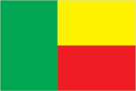
two equal horizontal bands of yellow (top) and red with a vertical green band on the hoist side
Location
9 30 N, 2 15 E -- Western Africa, bordering the North Atlantic Ocean, between Nigeria and Togo Flag ----
Geography
Area
- comparative area
- slightly smaller than Pennsylvania
- land area
- 110,620 sq km
- total area
- 112,620 sq km
Climate
tropical; hot, humid in south; semiarid in north
Coastline
121 km
Environment
- current issues
- recent droughts have severely affected marginal agriculture in north; inadequate supplies of potable water; poaching threatens wildlife populations; deforestation; desertification
- international agreements
- party to - Biodiversity, Climate Change, Endangered Species, Environmental Modification, Nuclear Test Ban, Ozone Layer Protection; signed, but not ratified - Desertification, Law of the Sea
- natural hazards
- hot, dry, dusty harmattan wind may affect north in winter
Geographic coordinates
9 30 N, 2 15 E
Geographic note
no natural harbors
International disputes
none
Irrigated land
60 sq km (1989 est.)
Land boundaries
- border countries
- Burkina Faso 306 km, Niger 266 km, Nigeria 773 km, Togo 644 km
- total
- 1,989 km
Land use
- arable land
- 12%
- forest and woodland
- 35%
- meadows and pastures
- 4%
- other
- 45%
- permanent crops
- 4%
Location
Western Africa, bordering the North Atlantic Ocean, between Nigeria and Togo
Map references
Africa
Maritime claims
- territorial sea
- 200 nm
Natural resources
small offshore oil deposits, limestone, marble, timber
Terrain
- mostly flat to undulating plain; some hills and low mountains
- highest point
- Mount Tanekas 641 m
- lowest point
- Atlantic Ocean 0 m
People and Society
Age structure
0-14 years: 48% (male 1,376,531; female 1,367,394) 15-64 years: 50% (male 1,349,386; female 1,480,251) 65 years and over: 2% (male 60,030; female 75,937) (July 1996 est.)
Birth rate
46.76 births/1,000 population (1996 est.)
Death rate
13.53 deaths/1,000 population (1996 est.)
Ethnic divisions
African 99% (42 ethnic groups, most important being Fon, Adja, Yoruba, Bariba), Europeans 5,500
Infant mortality rate
105.1 deaths/1,000 live births (1996 est.)
Languages
French (official), Fon and Yoruba (most common vernaculars in south), tribal languages (at least six major ones in north)
Life expectancy at birth
- female
- 54.7 years (1996 est.)
- male
- 50.74 years
- total population
- 52.69 years
Literacy
- age 15 and over can read and write (1995 est.)
- female
- 25.8%
- male
- 48.7%
- total population
- 37%
Nationality
- adjective
- Beninese
- noun
- Beninese (singular and plural)
Net migration rate
0 migrant(s)/1,000 population (1996 est.)
Population
5,709,529 (July 1996 est.)
Population growth rate
3.32% (1996 est.)
Religions
indigenous beliefs 70%, Muslim 15%, Christian 15%
Sex ratio
- all ages
- 0.95 male(s)/female (1996 est.)
- at birth
- 1.03 male(s)/female
- under 15 years
- 1.01 male(s)/female 15-64 years: 0.91 male(s)/female 65 years and over: 0.79 male(s)/female
Total fertility rate
6.64 children born/woman (1996 est.)
Government
Administrative divisions
6 provinces; Atakora, Atlantique, Borgou, Mono, Oueme, Zou
Capital
Porto-Novo
Constitution
2 December 1990
Data code
BN
Diplomatic representation in US
- chancery
- 2737 Cathedral Avenue NW, Washington, DC 20008
- chief of mission
- Ambassador Lucien Edgar TONOUKOUIN
- telephone
- [1] (202) 232-6656, 6657, 6658
Executive branch
- cabinet
- Executive Council, appointed by the president
- chief of state and head of government
- President Mathieu KEREKOU (since 4 April 1996) was elected for a five-year term by popular vote; election last held 18 March 1996 (next to be held March 2001); results - Mathieu KEREKOU 52.49%, Nicephore SOGLO 47.51%
FAX
- [1] (202) 265-1996
- [229] 30-14-39, 30-19-74
Flag
two equal horizontal bands of yellow (top) and red with a vertical green band on the hoist side
Independence
1 August 1960 (from France)
International organization participation
ACCT, ACP, AfDB, ECA, ECOWAS, Entente, FAO, FZ, G-77, IBRD, ICAO, ICFTU, ICRM, IDA, IDB, IFAD, IFC, IFRCS, ILO, IMF, IMO, Intelsat, Interpol, IOC, ITU, NAM, OAU, OIC, UN, UNCTAD, UNESCO, UNIDO, UNMIH, UPU, WADB, WCL, WFTU, WHO, WIPO, WMO, WToO
Judicial branch
Supreme Court (Cour Supreme)
Legal system
based on French civil law and customary law; has not accepted compulsory ICJ jurisdiction
Legislative branch
unicameral
Name of country
- conventional long form
- Republic of Benin
- conventional short form
- Benin
- former
- Dahomey
- local long form
- Republique du Benin
- local short form
- Benin
National Assembly (Assemblee Nationale)
elections last held 28 March 1995 (next to be held NA); results - percent of vote by party NA; seats - (83 total) Renaissance Party and allies 20, PRD 19, FARD-ALAFIA 10, PSD 7, NCC 3, RDL-VIVOTEN 3, Communist Party 2, Alliance Chameleon 1, RDP 1, ADP 1, other 16
National holiday
National Day, 1 August (1990)
Political parties and leaders
- as of February 1996, more than 80 political parties were officially recognized; the following are
- represented in the National Assembly
- Alliance of the National Party for Democracy and Development (PNDD) and the Democratic Renewal Party (PRD), Pascal Chabi KAO; Action for Renewal and Development (FARD-ALAFIA), Mathieu KEREKOU; Alliance of the Social Democratic Party (PSD) and the National Union for Solidarity and Progress (UNSP), Bruno AMOUSSOU; Alliance Chameleon; Alliance for Democracy and Progress (ADP), Adekpedjon AKINDES; Alliance for Social Democracy (ASD), Robert DOSSOU; Assembly of Liberal Democrats for National Reconstruction (RDL), Severin ADJOVI; Communist Party of Benin, Pascal FATONDJI, First Secretary; Our Common Cause (NCC), Albert TEVOEDJRE; Rally for Democracy and Progress (RDP); The Renaissance Party, Nicephore SOGLO
Suffrage
18 years of age; universal
Type of government
republic under multiparty democratic rule dropped Marxism-Leninism December 1989; democratic reforms adopted February 1990; transition to multiparty system completed 4 April 1991
US diplomatic representation
- chief of mission
- Ambassador John M. YATES
- embassy
- Rue Caporal Bernard Anani, Cotonou
- mailing address
- B. P. 2012, Cotonou
- telephone
- [229] 30-06-50, 30-05-13, 30-17-92
Economy
Agriculture
corn, sorghum, cassava (tapioca), yams, beans, rice, cotton, palm oil, peanuts; poultry, livestock
Budget
- expenditures
- $375 million, including capital expenditures of $84 million (1993 est.)
- revenues
- $272 million (1993 est.)
Currency
1 Communaute Financiere Africaine franc (CFAF) = 100 centimes
Economic aid
- recipient
- ODA, $NA
Economic overview
The economy of Benin remains underdeveloped and dependent on subsistence agriculture, cotton production, and regional trade. Growth in real output, which had averaged a sound 4% in 1990-94, rose to 6% in 1995. Rapid population growth, now 3.3% per year, offset much of this growth in output. Inflation jumped to 55% in 1994 (compared to 3% in 1993) following the 50% currency devaluation in January 1994, but subsided gradually in 1995. Commercial and transport activities, which make up 37% of GDP, are extremely vulnerable to developments in Nigeria as evidenced by decreased reexport trade in 1994 due to a severe contraction in Nigerian demand. Support by the Paris Club and official bilateral creditors has eased the external debt situation in recent years. The government, still burdened with money-losing state enterprises and a bloated civil service, has been gradually implementing a World Bank supported structural adjustment program since 1991.
Electricity
- capacity
- 30,000 kW
- consumption per capita
- 25 kWh (1993)
- production
- 10 million kWh
Exchange rates
- CFA francs (CFAF) per US$1 - 500.56 (January 1996), 499.15 (1995), 555.20 (1994), 283.16 (1993), 264.69 (1992), 282.11 (1991)
- note
- beginning 12 January 1994 the CFA franc was devalued to CFAF 100 per French franc from CFAF 50 at which it had been fixed since 1948
Exports
- $310 million (f.o.b., 1994 est.)
- commodities
- cotton, crude oil, palm products, cocoa
- partners
- France, Morocco 37%, Portugal 14%, Spain, Italy, UK, US, Libya
External debt
$1.5 billion (1993 est.)
Fiscal year
calendar year
GDP
purchasing power parity - $7.6 billion (1995 est.)
GDP composition by sector
- agriculture
- 36.8%
- industry
- 12.6%
- services
- 50.6% (1993)
GDP per capita
$1,380 (1995 est.)
GDP real growth rate
6% (1995 est.)
Illicit drugs
transshipment point for narcotics associated with Nigerian trafficking organizations and most commonly destined for Western Europe and the US
Imports
- $439 million (c.i.f., 1994 est.)
- commodities
- foodstuffs, beverages, tobacco, petroleum products, intermediate goods, capital goods, light consumer goods
- partners
- France 24%, Thailand 12%, Netherlands 7%, US 5%, China, Hong Kong
Industrial production growth rate
NA%
Industries
textiles, cigarettes; beverages, food; construction materials, petroleum
Inflation rate (consumer prices)
55% (1994 est.)
Labor force
- 1.9 million (1987)
- by occupation
- agriculture 60%, transport, commerce, and public services 38%, industry less than 2%
Unemployment rate
NA%
Communications
Branches
Armed Forces (includes Army, Navy, Air Force), National Gendarmerie
Defense expenditures
exchange rate conversion - $33 million, 3.2% of GDP (1994)
Manpower availability
- females age 15-49
- 1,290,773
- females fit for military service
- 653,094
- females reach military age (18) annually
- 60,968 (1996 est.)
- males age 15-49
- 1,212,440
- males fit for military service
- 620,923
- males reach military age (18) annually
- 62,526
- note
- both sexes are liable for military service
Radio broadcast stations
AM 2, FM 2, shortwave 0
Radios
NA
Telephone system
- domestic
- fair system of open wire and microwave radio relay
- international
- satellite earth station - 1 Intelsat (Atlantic Ocean); submarine cable
Telephones
16,200 (1986 est.)
Television broadcast stations
2
Televisions
20,000 (1993 est.) Defense
Transportation
Airports
- total
- 5
- with paved runways 2 438 to 3 047 m
- 2
- with unpaved runways 1 524 to 2 437 m
- 1
- with unpaved runways 914 to 1 523 m
- 2 (1995 est.)
Highways
- paved
- 1,214 km
- total
- 6,070 km
- unpaved
- 4,856 km (1992 est.)
Merchant marine
none
Ports
Cotonou, Porto-Novo
Railways
- narrow gauge
- 578 km 1.000-m gauge
- total
- 578 km (single track) (1995 est.)
Waterways
navigable along small sections, important only locally