1996 Edition
CIA World Factbook 1996 (Project Gutenberg)
Introduction
Description
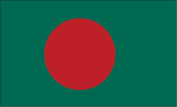
green with a large red disk slightly to the hoist side of center; green is the traditional color of Islam
Location
24 00 N, 90 00 E -- Southern Asia, bordering the Bay of Bengal, between Burma and India Flag ----
Geography
Area
- comparative area
- slightly smaller than Wisconsin
- land area
- 133,910 sq km
- total area
- 144,000 sq km
Climate
tropical; cool, dry winter (October to March); hot, humid summer (March to June); cool, rainy monsoon (June to October)
Coastline
580 km
Environment
- current issues
- many people are landless and forced to live on and cultivate flood-prone land; limited access to potable water; water-borne diseases prevalent; water pollution especially of fishing areas results from the use of commercial pesticides; intermittent water shortages because of falling water tables in the northern and central parts of the country; soil degradation; deforestation; severe overpopulation
- international agreements
- party to - Biodiversity, Climate Change, Endangered Species, Environmental Modification, Hazardous Wastes, Nuclear Test Ban, Ozone Layer Protection, Wetlands; signed, but not ratified - Desertification, Law of the Sea
- natural hazards
- droughts, cyclones; much of the country routinely flooded during the summer monsoon season
Geographic coordinates
24 00 N, 90 00 E
International disputes
a portion of the boundary with India in dispute; water-sharing problems with upstream riparian India over the Ganges
Irrigated land
27,380 sq km (1989)
Land boundaries
- border countries
- Burma 193 km, India 4,053 km
- total
- 4,246 km
Land use
- arable land
- 67%
- forest and woodland
- 16%
- meadows and pastures
- 4%
- other
- 11%
- permanent crops
- 2%
Location
Southern Asia, bordering the Bay of Bengal, between Burma and India
Map references
Asia
Maritime claims
- contiguous zone
- 18 nm
- continental shelf
- up to the outer limits of the continental margin
- exclusive economic zone
- 200 nm
- territorial sea
- 12 nm
Natural resources
natural gas, arable land, timber
Terrain
- mostly flat alluvial plain; hilly in southeast
- highest point
- Reng Tlang 957 m
- lowest point
- Indian Ocean 0 m
People and Society
Age structure
0-14 years: 39% (male 24,434,219; female 23,436,359) 15-64 years: 58% (male 36,607,942; female 34,603,628) 65 years and over: 3% (male 2,175,017; female 1,805,635) (July 1996 est.)
Birth rate
30.5 births/1,000 population (1996 est.)
Death rate
11.21 deaths/1,000 population (1996 est.)
Ethnic divisions
Bengali 98%, Biharis 250,000, tribals less than 1 million
Infant mortality rate
102.3 deaths/1,000 live births (1996 est.)
Languages
Bangla (official), English
Life expectancy at birth
- female
- 55.69 years (1996 est.)
- male
- 56.02 years
- total population
- 55.86 years
Literacy
- age 15 and over can read and write (1995 est.)
- female
- 26.1%
- male
- 49.4%
- total population
- 38.1%
Nationality
- adjective
- Bangladesh
- noun
- Bangladeshi(s)
Net migration rate
-0.78 migrant(s)/1,000 population (1996 est.)
Population
123,062,800 (July 1996 est.)
Population growth rate
1.85% (1996 est.)
Religions
Muslim 83%, Hindu 16%, Buddhist, Christian, other
Sex ratio
- all ages
- 1.06 male(s)/female (1996 est.)
- at birth
- 1.05 male(s)/female
- under 15 years
- 1.04 male(s)/female 15-64 years: 1.06 male(s)/female 65 years and over: 1.2 male(s)/female
Total fertility rate
3.57 children born/woman (1996 est.)
Government
Administrative divisions
- 4 divisions; Chittagong, Dhaka, Khulna, Rajshahi
- note
- there may be two new divisions named Barisal and Sylhet
Capital
Dhaka
Constitution
4 November 1972, effective 16 December 1972, suspended following coup of 24 March 1982, restored 10 November 1986, amended many times
Data code
BG
Diplomatic representation in US
- chancery
- 2201 Wisconsin Avenue NW, Washington, DC 20007
- chief of mission
- Ambassador Humayun KABIR
- consulate(s) general
- Los Angeles and New York
- telephone
- [1] (202) 342-8372 through 8376
Executive branch
- cabinet
- Advisory Council was appointed by the president on 3 April 1996
- chief of state
- President Abdur Rahman BISWAS (since 8 October 1991) was elected for a five-year term by National Parliament; election last held 8 October 1991 (next to be held by NA October 1996); results - Abdur Rahman BISWAS received 52.1% of parliamentary vote
- head of government
- Caretaker Prime Minister Muhammad Habibur RAHMAN (since 31 March 1996) was appointed by the president (see note under Legislative branch entry)
FAX
[880] (2) 883-744
Flag
green with a large red disk slightly to the hoist side of center; green is the traditional color of Islam
Independence
16 December 1971 (from Pakistan)
International organization participation
AsDB, C, CCC, CP, ESCAP, FAO, G-77, IAEA, IBRD, ICAO, ICFTU, ICRM, IDA, IDB, IFAD, IFC, IFRCS, ILO, IMF, IMO, Inmarsat, Intelsat, Interpol, IOC, IOM, ISO, ITU, MINURSO, NAM, OIC, SAARC, UN, UNAMIR, UNAVEM III, UNCRO, UNCTAD, UNESCO, UNHCR, UNIDO, UNIKOM, UNMIH, UNMOT, UNOMIG, UNPREDEP, UNPROFOR, UNU, UPU, WCL, WFTU, WHO, WIPO, WMO, WToO, WTrO
Judicial branch
Supreme Court, the Chief Justices and other judges are appointed by the president
Legal system
based on English common law
Legislative branch
unicameral
Name of country
- conventional long form
- People's Republic of Bangladesh
- conventional short form
- Bangladesh
- former
- East Pakistan
National holiday
Independence Day, 26 March (1971)
National Parliament (Jatiya Sangsad)
elections last held 15 February 1996 (next to be held NA); results - percent of vote by party NA; seats - (330 total, 300 elected and 30 seats reserved for women) seats by party NA; note - the election was held despite the fact that it was boycotted by the major opposition parties; Prime Minister Khaleda ZIAur RAHMAN's party won a landslide victory, but, under continuing pressure from the opposition, who called for an annulment of the results, National Parliament passed a bill that established a caretaker government to oversee new elections on a date yet to be determined; President BISWAS then dissolved Parliament and named a caretaker prime minister to replace Prime Minister ZIAur RAHMAN
Political parties and leaders
Bangladesh Nationalist Party (BNP), Khaleda ZIAur RAHMAN; Awami League (AL), Sheikh Hasina WAJED; Jatiyo Party (JP), Hussain Mohammad ERSHAD (in jail); Jamaat-E-Islami (JI), Motiur Rahman NIZAMI; Bangladesh Communist Party (BCP), Saifuddin Ahmed MANIK; National Awami Party (Muzaffar); Workers Party, Rashid Khan MENON; Jatiyo Samajtantik Dal (JSD), Serajul ALAM KHAN; Ganotantri Party, leader NA; Islami Oikya Jote, leader NA; National Democratic Party (NDP), leader NA; Muslim League, Khan A. SABUR; Democratic League, Khondakar MUSHTAQUE Ahmed; United People's Party, Kazi ZAFAR Ahmed
Suffrage
18 years of age; universal
Type of government
republic
US diplomatic representation
- chief of mission
- Ambassador David N. MERRILL
- embassy
- Diplomatic Enclave, Madani Avenue, Baridhara, Dhaka
- mailing address
- G.P.O. Box 323, Dhaka 1000; Dhaka 1212
- telephone
- [880] (2) 884700 through 884722
Economy
Agriculture
jute, rice, wheat, tea, sugarcane, potatoes; beef, milk, poultry
Budget
- expenditures
- $4.1 billion, including capital expenditures of $1.8 billion (FY92/93)
- revenues
- $2.8 billion
Currency
1 taka (Tk) = 100 poiska
Economic aid
- recipient
- ODA, $1.099 billion (1993)
Economic overview
Despite sustained domestic and international efforts to improve economic and demographic prospects, Bangladesh remains one of the world's poorest, most densely populated, and least developed nations. Annual GDP growth has averaged over 4% in recent years from a low base. Its economy is overwhelmingly agricultural, with the cultivation of rice the single most important activity in the economy. Major impediments to growth include frequent cyclones and floods, the inefficiency of state-owned enterprises, a rapidly growing labor force that cannot be absorbed by agriculture, delays in exploiting energy resources (natural gas), inadequate power supplies, and, most recently, political disturbances. In 1995, progress on Bangladesh's development agenda has been slowed by frequent political unrest before and after national elections in early 1996. Opposition parties have challenged the government's authority by resigning from Parliament and sponsoring numerous countrywide strikes that have crippled transport, hindered business activity, and threatened to slow economic growth in 1996.
Electricity
- capacity
- 2,740,000 kW
- consumption per capita
- 70 kWh (1993)
- production
- 9.2 billion kWh
Exchange rates
taka (Tk) per US$1 - 40.933 (January 19965), 40.278 (1995), 40.212 (1994), 39.567 (1993), 38.951 (1992), 36.596 (1991)
Exports
- $2.7 billion (1995 est.)
- commodities
- garments, jute and jute goods, leather, shrimp
- partners
- US 33%, Western Europe 39% (Germany 8.4%, Italy 6%) (FY91/92 est.)
External debt
$15.7 billion (1995 est.)
Fiscal year
1 July - 30 June
GDP
purchasing power parity - $144.5 billion (1995 est.)
GDP composition by sector
- agriculture
- NA%
- industry
- NA%
- services
- NA%
GDP per capita
$1,130 (1995 est.)
GDP real growth rate
4.6% (1995 est.)
Illicit drugs
transit country for illegal drugs produced in neighboring countries
Imports
- $4.7 billion (1995 est.)
- commodities
- capital goods, petroleum, food, textiles
- partners
- Hong Kong 7.5%, Singapore 7.4%, China 7.4%, Japan 7.1% (FY91/92 est.)
Industrial production growth rate
8.5% (1995 est.)
Industries
jute manufacturing, cotton textiles, food processing, steel, fertilizer
Inflation rate (consumer prices)
4.5% (1995 est.)
Labor force
- 50.1 million
- by occupation
- agriculture 65%, services 21%, industry and mining 14% (1989)
- note
- extensive export of labor to Saudi Arabia, UAE, and Oman (1991)
Unemployment rate
NA%
Communications
Branches
Army, Navy, Air Force, paramilitary forces (includes Bangladesh Rifles, Bangladesh Ansars, Armed Police Reserve, Village Defense Parties, National Cadet Corps)
Defense expenditures
exchange rate conversion - $481 million, 1.7% of GDP (FY95/96)
Manpower availability
- males age 15-49
- 31,795,848
- males fit for military service
- 18,814,818 (1996 est.)
Radio broadcast stations
AM 9, FM 6, shortwave 0
Radios
NA
Telephone system
- domestic
- poor domestic telephone service
- international
- satellite earth stations - 2 Intelsat (Indian Ocean); international radiotelephone communications and landline service to neighboring countries
Telephones
249,800 (1994 est.)
Television broadcast stations
11
Televisions
350,000 (1993 est.) Defense
Transportation
Airports
- total
- 15
- with paved runways 1 524 to 2 437 m
- 4
- with paved runways 2 438 to 3 047 m
- 2
- with paved runways 914 to 1 523 m
- 1
- with paved runways over 3 047 m
- 2
- with paved runways under 914 m
- 6 (1995 est.)
Highways
- paved
- 8,546 km
- total
- 13,627 km
- unpaved
- 5,081 km (1992)
Merchant marine
- ships by type
- bulk 3, cargo 29, oil tanker 2, refrigerated cargo 3 (1995 est.)
- total
- 37 ships (1,000 GRT or over) totaling 296,503 GRT/423,274 DWT
Pipelines
natural gas 1,220 km
Ports
Chittagong, Dhaka, Chalna Port (Mongla)
Railways
- broad gauge
- 978 km 1.676-m gauge
- narrow gauge
- 1,914 km 1.000-m gauge (1992)
- total
- 2,892 km
Waterways
5,150-8,046 km navigable waterways (includes 2,575-3,058 km main cargo routes)