1990 Edition
CIA World Factbook 1990 (Project Gutenberg)
Geography
Climate
tropical; cool, dry winter (October to March); hot, humid summer
Coastline
580 km
Comparative area
slightly smaller than Wisconsin
Contiguous zone
18 nm;
Continental shelf
up to outer limits of continental margin;
Disputes
a portion of the boundary with India is in dispute; water sharing problems with upstream riparian India over the Ganges
Environment
vulnerable to droughts; much of country routinely flooded during summer monsoon season; overpopulation; deforestation
Extended economic zone
200 nm;
Land boundaries
4,246 km total; Burma 193 km, India 4,053 km
Land use
67% arable land; 2% permanent crops; 4% meadows and pastures; 16% forest and woodland; 11% other; includes 14% irrigated
Natural resources
natural gas, uranium, arable land, timber
Note
almost completely surrounded by India
Terrain
mostly flat alluvial plain; hilly in southeast
Territorial sea
12 nm
Total area
144,000 km2; land area: 133,910 km2
People and Society
Birth rate
42 births/1,000 population (1990)
Death rate
14 deaths/1,000 population (1990)
Ethnic divisions
98% Bengali; 250,000 Biharis, and less than 1 million tribals
Infant mortality rate
136 deaths/1,000 live births (1990)
Labor force
35,100,000; 74% agriculture, 15% services, 11% industry and commerce; extensive export of labor to Saudi Arabia, UAE, Oman, and Kuwait
Language
Bangla (official), English widely used
Life expectancy at birth
54 years male, 53 years female (1990)
Literacy
29% (39% men, 18% women)
Nationality
noun--Bangladeshi(s); adjective--Bangladesh
Net migration rate
0 migrants/1,000 population (1990)
Organized labor
3% of labor force belongs to 2,614 registered unions
Population
118,433,062 (July 1990), growth rate 2.8% (1990)
Religion
83% Muslim, about 16% Hindu, less than 1% Buddhist, Christian, and other
Total fertility rate
5.7 children born/woman (1990)
Government
Administrative divisions
64 districts (zillagulo, singular--zilla); Bagerhat, Bandarban, Barisal, Bhola, Bogra, Borguna, Brahmanbaria, Chandpur, Chapai Nawabganj, Chattagram, Chuadanga, Comilla, Cox's Bazar, Dhaka, Dinajpur, Faridpur, Feni, Gaibandha, Gazipur, Gopalganj, Habiganj, Jaipurhat, Jamalpur, Jessore, Jhalakati, Jhenaidah, Khagrachari, Khulna, Kishorganj, Kurigram, Kushtia, Laksmipur, Lalmonirhat, Madaripur, Magura, Manikganj, Meherpur, Moulavibazar, Munshiganj, Mymensingh, Naogaon, Narail, Narayanganj, Narsingdi, Nator, Netrakona, Nilphamari, Noakhali, Pabna, Panchagar, Parbattya Chattagram, Patuakhali, Pirojpur, Rajbari, Rajshahi, Rangpur, Satkhira, Shariyatpur, Sherpur, Sirajganj, Sunamganj, Sylhet, Tangail, Thakurgaon
Capital
Dhaka
Communists
5,000 members (1987 est.)
Constitution
4 November 1972, effective 16 December 1972, suspended following coup of 24 March 1982, restored 10 November 1986
Diplomatic representation
Ambassador A. H. S. Ataul KARIM; Chancery at 2201 Wisconsin Avenue NW, Washington DC 20007; telephone (202) 342-8372 through 8376; there is a Bangladesh Consulate General in New York; US--Ambassador-designate William B. MILAM; Embassy at Diplomatic Enclave, Madani Avenue, Baridhara Model Town, Dhaka (mailing address is G. P. O. Box 323, Ramna, Dhaka); telephone [88] (2) 608170
Elections
President--last held 15 October 1986 (next to be held October 1991); results--President Hussain Mohammad Ershad received 83.5% of vote; Parliament--last held 3 March 1988 (next to be held March 1993); results--percent of vote by party NA; seats--(330 total, 300 elected and 30 seats reserved for women) Jatiyo Party won 256 out of 300 seats
Executive branch
president, vice president, prime minister, three deputy prime ministers, Council of Ministers (cabinet)
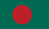
Flag
green with a large red disk slightly to the hoist side of center; green is the traditional color of Islam
Independence
16 December 1971 (from Pakistan; formerly East Pakistan)
Judicial branch
Supreme Court
Leaders
Chief of State--President Hussain Mohammad ERSHAD (since 11 December 1983, elected 15 October 1986); Vice President Moudad AHMED (since 12 August 1989); Head of Government--Prime Minister Qazi Zafar AHMED (since 12 August 1989)
Legal system
based on English common law
Legislative branch
unicameral Parliament (Jatiya Sangsad)
Long-form name
People's Republic of Bangladesh
Member of
ADB, CCC, Colombo Plan, Commonwealth, ESCAP, FAO, G-77, GATT, IAEA, IBRD, ICAO, IDA, IDB--Islamic Development Bank, IFAD, IFC, ILO, IMF, IMO, INTELSAT, INTERPOL, IRC, ITU, NAM, OIC, SAARC, UN, UNCTAD, UNESCO, UPU, WHO, WFTU, WMO, WTO
National holiday
Independence Day, 26 March (1971)
Political parties and leaders
Jatiyo Party, Hussain Mohammad Ershad; Bangladesh Nationalist Party, Begum Ziaur Rahman; Awami League, Sheikh Hasina Wazed; United People's Party, Kazi Zafar Ahmed; Democratic League, Khondakar Mushtaque Ahmed; Muslim League, Khan A. Sabur; Jatiyo Samajtantrik Dal (National Socialist Party), M. A. Jalil; Bangladesh Communist Party (pro-Soviet), Saifuddin Ahmed Manik; Jamaat-E-Islami, Ali Khan
Suffrage
universal at age 18
Type
republic
Economy
Agriculture
accounts for about 50% of GDP and 74% of both employment and exports; imports 10% of food grain requirements; world's largest exporter of jute; commercial products--jute, rice, wheat, tea, sugarcane, potatoes, beef, milk, poultry; shortages include wheat, vegetable oils and cotton; fish catch 778,000 metric tons in 1986
Aid
US commitments, including Ex-Im (FY70-87), $3.2 billion; Western (non-US) countries, ODA and OOF bilateral commitments (1980-87), $9.5 billion; OPEC bilateral aid (1979-89), $652 million; Communist countries (1970-88), $1.5 billion
Budget
revenues $1.8 billion; expenditures $3.3 billion, including capital expenditures of $1.7 billion (FY89)
Currency
taka (plural--taka); 1 taka (Tk) = 100 paise
Electricity
1,700,000 kW capacity; 4,900 million kWh produced, 40 kWh per capita (1989)
Exchange rates
taka (Tk) per US$1--32.270 (January 1990), 32.270 (1989), 31.733 (1988), 30.950 (1987), 30.407 (1986), 27.995 (1985)
Exports
$1.3 billion (f.o.b., FY89 est.); commodities--jute, tea, leather, shrimp, manufacturing; partners--US 25%, Western Europe 22%, Middle East 9%, Japan 8%, Eastern Europe 7%
External debt
$10.4 billion (December 1989)
Fiscal year
1 July-30 June
GDP
$20.6 billion, per capita $180; real growth rate 2.1% (FY89 est.)
Imports
$3.1 billion (c.i.f., FY89 est.); commodities--food, petroleum and other energy, nonfood consumer goods, semiprocessed goods, and capital equipment; partners--Western Europe 18%, Japan 14%, Middle East 9%, US 8%
Industrial production
growth rate 5.4% (FY89 est.)
Industries
jute manufacturing, food processing, cotton textiles, petroleum, urea fertilizer
Inflation rate (consumer prices)
8-10% (FY89 est.)
Overview
The economy is based on the output of a narrow range of agricultural products, such as jute, which is the main cash crop and major source of export earnings. Bangladesh is hampered by a relative lack of natural resources, a rapid population growth of 2.8% a year and a limited infrastructure, and it is highly vulnerable to natural disasters. Despite these constraints, real GDP averaged about 3.8% annually during 1985-88. One of the poorest nations in the world, alleviation of poverty remains the cornerstone of the government's development strategy. The agricultural sector contributes over 50% to GDP and 75% to exports, and employs over 74% of the labor force. Industry accounts for about 10% of GDP.
Unemployment rate
30% (FY88 est.)
Communications
Airports
16 total, 13 usable; 13 with permanent-surface runways; none with runways over 3,659 m; 4 with runways 2,440-3,659 m; 7 with runways 1,220-2,439 m
Civil air
15 major transport aircraft
Highways
7,240 km total (1985); 3,840 km paved, 3,400 km unpaved
Inland waterways
5,150-8,046 km navigable waterways (includes 2,575-3,058 km main cargo routes)
Merchant marine
47 ships (1,000 GRT or over) totaling 331,568 GRT/493,935 DWT; includes 38 cargo, 2 petroleum, oils, and lubricants (POL) tanker, 3 refrigerated cargo, 1 roll-on/roll-off, 3 bulk
Pipelines
650 km natural gas
Ports
Chittagong, Chalna
Railroads
2,892 km total (1986); 1,914 km 1.000 meter gauge, 978 km 1.676 meter broad gauge
Telecommunications
adequate international radio communications and landline service; fair domestic wire and microwave service; fair broadcast service; 182,000 telephones; stations--9 AM, 6 FM, 11 TV; 2 Indian Ocean INTELSAT satellite earth stations
Military and Security
Branches
Army, Navy, Air Force; paramilitary forces--Bangladesh Rifles, Bangladesh Ansars, Armed Police Reserve, Coastal Police
Defense expenditures
1.5% of GDP, or $309 million (FY90 est.)
Military manpower
males 15-49, 28,110,802; 16,686,644 fit for military service