1996 Edition
CIA World Factbook 1996 (Project Gutenberg)
Introduction
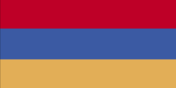
Description
three equal horizontal bands of red (top), blue, and gold
Location
40 00 N, 45 00 E -- Southwestern Asia, east of Turkey Flag ----
Geography
Area
- comparative area
- slightly larger than Maryland
- land area
- 28,400 sq km
- total area
- 29,800 sq km
Climate
highland continental, hot summers, cold winters
Coastline
0 km (landlocked)
Environment
- current issues
- soil pollution from toxic chemicals such as DDT; energy blockade, the result of conflict with Azerbaijan, has led to deforestation as citizens scavenge for firewood; pollution of Hrazdan (Razdan) and Aras Rivers; the draining of Sevana Lich, a result of its use as a source for hydropower, threatens drinking water supplies; restart of Metsamor nuclear power plant without adequate (IAEA-recommended) safety and backup systems
- international agreements
- party to - Biodiversity, Climate Change, Nuclear Test Ban, Wetlands; signed, but not ratified - Desertification
- natural hazards
- occasionally severe earthquakes; droughts
Geographic coordinates
40 00 N, 45 00 E
Geographic note
landlocked
International disputes
supports ethnic Armenians in Nagorno-Karabakh in their separatist conflict against the Azerbaijani Government; traditional demands on former Armenian lands in Turkey have subsided
Irrigated land
3,050 sq km (1990)
Land boundaries
- border countries
- Azerbaijan-proper 566 km, Azerbaijan-Naxcivan exclave 221 km, Georgia 164 km, Iran 35 km, Turkey 268 km
- total
- 1,254 km
Land use
- arable land
- 17%
- forest and woodland
- 0%
- meadows and pastures
- 20%
- other
- 60%
- permanent crops
- 3%
Location
Southwestern Asia, east of Turkey
Map references
Commonwealth of Independent States
Maritime claims
none (landlocked)
Natural resources
small deposits of gold, copper, molybdenum, zinc, alumina
Terrain
- high Armenian Plateau with mountains; little forest land; fast flowing rivers; good soil in Aras River valley
- highest point
- Aragats Lerr 4,095 m
- lowest point
- Debed River 400 m
People and Society
Age structure
0-14 years: 28% (male 497,461; female 476,649) 15-64 years: 64% (male 1,085,935; female 1,132,282) 65 years and over: 8% (male 111,661; female 159,586) (July 1996 est.)
Birth rate
16.27 births/1,000 population (1996 est.)
Death rate
7.73 deaths/1,000 population (1996 est.)
Ethnic divisions
- Armenian 93%, Azeri 3%, Russian 2%, other (mostly Yezidi Kurds) 2% (1989)
- note
- as of the end of 1993, virtually all Azeris had emigrated from
Infant mortality rate
38.9 deaths/1,000 live births (1996 est.)
Life expectancy at birth
- female
- 73.92 years (1996 est.)
- male
- 64.44 years
- total population
- 69.06 years
Nationality
- adjective
- Armenian
- noun
- Armenian(s)
Net migration rate
-8.3 migrant(s)/1,000 population (1996 est.)
Population
3,463,574 (July 1996 est.)
Population growth rate
0.02% (1996 est.)
Sex ratio
- all ages
- 0.96 male(s)/female (1996 est.)
- at birth
- 1.05 male(s)/female
- under 15 years
- 1.04 male(s)/female 15-64 years: 0.96 male(s)/female 65 years and over: 0.7 male(s)/female
Total fertility rate
2.06 children born/woman (1996 est.)