2006 Edition
CIA World Factbook 2006 (Project Gutenberg)
Introduction
Area
- note
- includes a salt lake and wetlands
- total
- 123 sq km
Area - comparative
about 0.7 times the size of Washington, DC
Background
By terms of the 1960 Treaty of Establishment that created the independent Republic of Cyprus, the UK retained full sovereignty and jurisdiction over two areas of almost 254 square kilometers - Akrotiri and Dhekelia. The southernmost and smallest of these is the Akrotiri Sovereign Base Area, which is also referred to as the Western Sovereign Base Area. Geography Akrotiri
Capital
- daylight saving time
- +1hr, begins last Sunday in March; ends last Sunday in October
- geographic coordinates
- 34 40 N, 32 51 E
- name
- Episkopi Cantonment; also serves as capital of Dhekelia
- time difference
- UTC+2 (7 hours ahead of Washington, DC during Standard Time)
Climate
temperate; Mediterranean with hot, dry summers and cool winters
Coastline
56.3 km
Constitution
Sovereign Base Areas of Akrotiri and Dhekelia Order in Council 1960, effective 16 August 1960
Country name
- conventional long form
- Akrotiri Sovereign Base Area
- conventional short form
- Akrotiri
Dependency status
overseas territory of UK; administered by an administrator who is also the Commander, British Forces Cyprus
Diplomatic representation from the US
none (overseas territory of the UK)
Diplomatic representation in the US
none (overseas territory of the UK)
Economy - overview
Economic activity is limited to providing services to the military and their families located in Akrotiri. All food and manufactured goods must be imported. Communications Akrotiri
Environment - current issues
shooting around the salt lake; note - breeding place for loggerhead and green turtles; only remaining colony of griffon vultures is on the base
Executive branch
- chief of state
- Queen ELIZABETH II (since 6 February 1952)
- elections
- none; the monarch is hereditary; the administrator is appointed by the monarch
- head of government
- Administrator Air Vice-Marshal Richard LACEY (since 26 April 2006); note - reports to the British Ministry of Defence
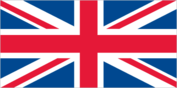
Flag description
the flag of the UK is used Economy Akrotiri
Geographic coordinates
34 37 N, 32 58 E
Geography - note
British extraterritorial rights also extended to several small off-post sites scattered across Cyprus People Akrotiri
Land boundaries
- border countries
- Cyprus 47.4 km
- total
- 47.4 km
Languages
English, Greek Government Akrotiri
Legal system
the laws of the UK, where applicable, apply
Location
peninsula on the southwest coast of Cyprus
Map references
Middle East
Military - note
Akrotiri has a full RAF base, Headquarters for British Forces on Cyprus, and Episkopi Support Unit This page was last updated on 19 December, 2006
Population
- no indigenous inhabitants
- note
- approximately 1,300 military personnel are on the base; there are another 5,000 British citizens who are families of military personnel or civilian staff on both Akrotiri and Dhekelia; Cyprus citizens work on the base, but do not live there
Radio broadcast stations
- FM 1
- note
- British Forces Broadcasting Service (BFBS) provides Radio 1 and Radio 2 service to Akrotiri, Dhekelia, and Nicosia (2006)
Television broadcast stations
British Forces Broadcasting Service (BFBS) provides multi-channel satellite service to Akrotiri, Dhekelia, and Nicosia (2006) Military Akrotiri