1993 Edition
CIA World Factbook 1993 (Project Gutenberg)
Geography
Area
total area: 647,500 km2 land area: 647,500 km2 comparative area: slightly smaller than Texas
Climate
arid to semiarid; cold winters and hot summers
Coastline
0 km (landlocked)
Environment
damaging earthquakes occur in Hindu Kush mountains; soil degradation, desertification, overgrazing, deforestation, pollution, flooding
International disputes
periodic disputes with Iran over Helmand water rights; Iran supports clients in country, private Pakistani and Saudi sources may also be active; power struggles among various groups for control of Kabul, regional rivalries among emerging warlords, traditional tribal disputes continue; support to Islamic fighters in Tajikistan's civil war; border dispute with Pakistan (Durand Line)
Irrigated land
26,600 km2 (1989 est.)
Land boundaries
total 5,529 km, China 76 km, Iran 936 km, Pakistan 2,430 km, Tajikistan 1,206 km, Turkmenistan 744 km, Uzbekistan 137 km
Land use
arable land: 12% permanent crops: 0% meadows and pastures: 46% forest and woodland: 3% other: 39%
Location
South Asia, between Iran and Pakistan
Map references
Asia, Middle East, Standard Time Zones of the World
Maritime claims
none; landlocked
Natural resources
natural gas, petroleum, coal, copper, talc, barites, sulphur, lead, zinc, iron ore, salt, precious and semiprecious stones
Note
landlocked
Terrain
mostly rugged mountains; plains in north and southwest
People and Society
Birth rate
43.83 births/1,000 population (1993 est.)
Death rate
19.33 deaths/1,000 population (1993 est.)
Ethnic divisions
Pashtun 38%, Tajik 25%, Uzbek 6%, Hazara 19%, minor ethnic groups (Chahar Aimaks, Turkmen, Baloch, and others)
Infant mortality rate
158.9 deaths/1,000 live births (1993 est.)
Labor force
4.98 million by occupation: agriculture and animal husbandry 67.8%, industry 10.2%, construction 6.3%, commerce 5.0%, services and other 10.7% (1980 est.)
Languages
Pashtu 35%, Afghan Persian (Dari) 50%, Turkic languages (primarily Uzbek and Turkmen) 11%, 30 minor languages (primarily Balochi and Pashai) 4%, much bilingualism
Life expectancy at birth
total population: 44.41 years male: 45.09 years female: 43.71 years (1993 est.)
Literacy
age 15 and over can read and write (1990) total population: 29% male: 44% female: 14%
Nationality
noun: Afghan(s) adjective: Afghan
Net migration rate
0 migrant(s)/1,000 population (1993 est.)
Population
16,494,145 (July 1993 est.)
Population growth rate
2.45% (1993 est.)
Religions
Sunni Muslim 84%, Shi'a Muslim 15%, other 1%
Total fertility rate
6.34 children born/woman (1993 est.)
Government
Administrative divisions
30 provinces (velayat, singular - velayat); Badakhshan, Badghis, Baghlan, Balkh, Bamian, Farah, Faryab, Ghazni, Ghowr, Helmand, Herat, Jowzjan, Kabol, Kandahar, Kapisa, Konar, Kondoz, Laghman, Lowgar, Nangarhar, Nimruz, Oruzgan, Paktia, Paktika, Parvan, Samangan, Sar-e Pol, Takhar, Vardak, Zabol note: there may be a new province of Nurestan (Nuristan)
Capital
Kabul
Chief of State
President Burhanuddin RABBANI (since 2 January 1993); First Vice President Mohammad NABI Mohammadi (since NA); First Vice President Mohammad SHAH Fazli (since NA)
Constitution
the old Communist-era constitution has been suspended; a new Islamic constitution has yet to be ratified
Digraph
AF
Diplomatic representation in US
chief of mission: (vacant); Charge d'Affaires Abdul RAHIM chancery: 2341 Wyoming Avenue NW, Washington, DC 20008 telephone: (202) 234-3770 or 3771
Executive branch
president, prime minister; Afghan leaders are still in the process of choosing a cabinet (May 1993)
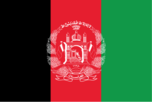
Flag
a new flag of unknown description reportedly has been adopted; previous flag consisted of three equal horizontal bands of black (top), red, and green, with the national coat of arms superimposed on the hoist side of the black and red bands; similar to the flag of Malawi, which is shorter and bears a radiant, rising red sun centered in the black band
Head of Government
Prime Minister-designate Gulbaddin HIKMATYAR (since NA); Deputy Prime Minister Sulayman GAILANI (since NA); Deputy Prime Minister Din MOHAMMAD (since NA); Deputy Prime Minister Ahmad SHAH Ahmadzai (since NA)
Independence
19 August 1919 (from UK)
Judicial branch
an interim Chief Justice of the Supreme Court has been appointed, but a new court system has not yet been organized
Legal system
a new legal system has not been adopted but the transitional government has declared it will follow Islamic law (Shari'a)
Legislative branch
a unicameral parliament consisting of 205 members was chosen by the shura in January 1993; non-functioning as of June 1993
Member of
AsDB (has previously been a member of), CP, ECO, ESCAP, FAO, G-77, IAEA, IBRD, ICAO, IDA, IDB, IFAD, IFC, ILO, IMF, INTELSAT, IOC, ITU, LORCS, NAM, OIC, UN, UNCTAD, UNESCO, UNIDO, UPU, WFTU, WHO, WMO, WTO
Names
conventional long form: Islamic State of Afghanistan conventional short form: Afghanistan former: Republic of Afghanistan
National holiday
Victory of the Muslim Nation, 28 April; Remembrance Day for Martyrs and Disabled, 4 May; Independence Day, 19 August
Other political or pressure groups
the former resistance commanders are the major power brokers in the countryside; shuras (councils) of commanders are now administering most cities outside Kabul; ulema (religious scholars); tribal elders
Political parties and leaders
current political organizations include Jamiat-i-Islami (Islamic Society), Burhanuddin RABBANI, Ahmad Shah MASOOD; Hizbi Islami-Gulbuddin (Islamic Party), Gulbuddin HIKMATYAR faction; Hizbi Islami-Khalis (Islamic Party) Yunis KHALIS faction; Ittihad-i-Islami Barai Azadi Afghanistan (Islamic Union for the Liberation of Afghanistan), Abdul Rasul SAYYAF; Harakat-Inqilab-i-Islami (Islamic Revolutionary Movement), Mohammad Nabi MOHAMMADI; Jabha-i-Najat-i-Milli Afghanistan (Afghanistan National Liberation Front), Sibghatullah MOJADDEDI; Mahaz-i-Milli-Islami (National Islamic Front), Sayed Ahamad GAILANI; Hizbi Wahdat (Islamic Unity Party), Abdul Ali MAZARI; Harakat-i-Islami (Islamic Movement), Mohammed Asif MOHSENI; a new northern organization consisting of resistance and former regional figures is Jonbesh-i-Milli Islami (National Islamic Movement), Rashid DOSTUM note: the former ruling Watan Party has been disbanded
President
last held NA December 1992 (next to be held NA December 1994); results - Burhanuddin RABBANI was elected to a two-year term by a national shura
Suffrage
undetermined; previously universal, male ages 15-50
Type
transitional government
US diplomatic representation
chief of mission: (vacant) embassy: Ansari Wat, Wazir Akbar Khan Mina, Kabul mailing address: use embassy street address telephone: 62230 through 62235 or 62436 note: US Embassy in Kabul was closed in January 1989
Economy
Agriculture
largely subsistence farming and nomadic animal husbandry; cash products - wheat, fruits, nuts, karakul pelts, wool, mutton
Budget
revenues $NA; expenditures $NA, including capital expenditures of $NA
Currency
1 afghani (AF) = 100 puls
Economic aid
US commitments, including Ex-Im (FY70-89), $380 million; Western (non-US) countries, ODA and OOF bilateral commitments (1970-89), $510 million; OPEC bilateral aid (1979-89), $57 million; Communist countries (1970-89), $4.1 billion; net official Western disbursements (1985-89), $270 million
Electricity
480,000 kW capacity; 1,000 million kWh produced, 60 kWh per capita (1992)
Exchange rates
afghanis (Af) per US$1 - 1,019 (March 1993), 900 (November 1991), 850 (1991), 700 (1989-90), 220 (1988-89); note - these rates reflect the free market exchange rates rather than the official exchange rates
Exports
$236 million (f.o.b., FY91 est.) commodities: natural gas 55%, fruits and nuts 24%, handwoven carpets, wool, cotton, hides, and pelts partners: former USSR, Pakistan
External debt
$2.3 billion (March 1991 est.)
Fiscal year
21 March - 20 March
Illicit drugs
an illicit producer of opium poppy and cannabis for the international drug trade; world's second-largest opium producer (after Burma) and a major source of hashish
Imports
$874 million (c.i.f., FY91 est.) commodities: food and petroleum products partners: former USSR, Pakistan
Industrial production
growth rate 2.3% (FY91 est.); accounts for about 25% of GDP
Industries
small-scale production of textiles, soap, furniture, shoes, fertilizer, and cement; handwoven carpets; natural gas, oil, coal, copper
Inflation rate (consumer prices)
over 90% (1991 est.)
National product
GDP - exchange rate conversion - $3 billion (1989 est.)
National product per capita
$200 (1989 est.)
National product real growth rate
NA%
Overview
Fundamentally, Afghanistan is an extremely poor, landlocked country, highly dependent on farming (wheat especially) and livestock raising (sheep and goats). Economic considerations have played second fiddle to political and military upheavals during more than 13 years of war, including the nearly 10-year Soviet military occupation (which ended 15 February 1989). Over the past decade, one-third of the population fled the country, with Pakistan sheltering more than 3 million refugees and Iran about 1.3 million. Another 1 million probably moved into and around urban areas within Afghanistan. Although reliable data are unavailable, gross domestic product is lower than 12 years ago because of the loss of labor and capital and the disruption of trade and transport.
Unemployment rate
NA%
Communications
Airports
total: 41 usable: 36 with permanent-surface runways: 9 with runways over 3,659 m: with runways 2,440-3,659 m: 11 with runways 1,220-2,439 m: 16
Highways
21,000 km total (1984); 2,800 km hard surface, 1,650 km bituminous-treated gravel and improved earth, 16,550 km unimproved earth and tracks
Inland waterways
total navigability 1,200 km; chiefly Amu Darya, which handles vessels up to about 500 metric tons
Pipelines
petroleum products - Uzbekistan to Bagram and Turkmenistan to Shindand; natural gas 180 km
Ports
Shir Khan and Kheyrabad (river ports)
Railroads
9.6 km (single track) 1.524-meter gauge from Kushka (Turkmenistan) to Towraghondi and 15.0 km from Termez (Uzbekistan) to Kheyrabad transshipment point on south bank of Amu Darya
Telecommunications
limited telephone, telegraph, and radiobroadcast services; television introduced in 1980; 31,200 telephones; broadcast stations - 5 AM, no FM, 1 TV; 1 satellite earth station
Military and Security
Branches
the military still does not yet exist on a national scale; some elements of the former Army, Air and Air Defense Forces, National Guard, Border Guard Forces, National Police Force (Sarandoi), and tribal militias remain intact
Defense expenditures
the new government has not yet adopted a defense budget
Manpower availability
males age 15-49 4,094,481; fit for military service 2,196,136; reach military age (22) annually 153,333 (1993 est.)