Browse Maps
Explore historical maps organized by time period
ancient
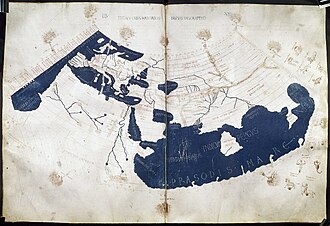
Ptolemy's World Map (c. 150 CE)
One of the earliest known world maps based on Claudius Ptolemy's Geographia, depicting the known world of the 2nd century.
ancient
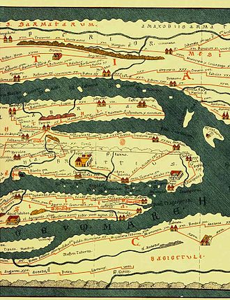
Tabula Peutingeriana
Tabula Peutingeriana, also known as Peutinger's Tabula, Peutinger tables and Peutinger Table, is an illustrated itinerarium showing the layout of the
ancient
Roman Empire at its Height (117 AD)
ancient
Silk Road Trade Routes
Our Partners
Trusted partner applications powering global data and insights